But time goes by, the allure of a good adventure remains - and grows, of course - and finally Tom suggested we give it a go now before the meager snowpack starts to bump the river volume up to possibly non-pack raft-friendly flows. So, with my legs and body still weary from a weekend of powder kegging (which Noah summarized well enough that I don't need to do here, or maybe I will later), Tom and I found ourselves at Elephant Hill in Canyonlands feeling very far from water but ready to charge to the rio.
But before we got to the trailhead we had to run the gauntlet of the National Park Service permitting system. We knew that permit availability this time of year would be a given, but the NPS is notorious for making river running more challenging than it should be (despite the fact that Yellowstone is as populated as it is and powerboats are allowed on all it's lakes, actually boating the rivers is apparently too impactful, so all rivers in Yellowstone are banned to watercraft! But don't get me started....). In the case of Cataract, the regulations include a required extra paddle, a fire pan, a groover, and an extra pfd. Challenging stuff when you're already carrying a boat, dry top/bottoms, food, full camping gear, water, helmet, and pfd....on your back. We of course considered blowing off the permit completely - which cost us $70, for two days - but a few minutes on The Google indicated that the fine could be upwards of $5k, so it seemed like a worthy investment, despite the fact that we knew the ranger gave us a bald-faced lie when he said "the river is well-patrolled, so keep this permit handy!"
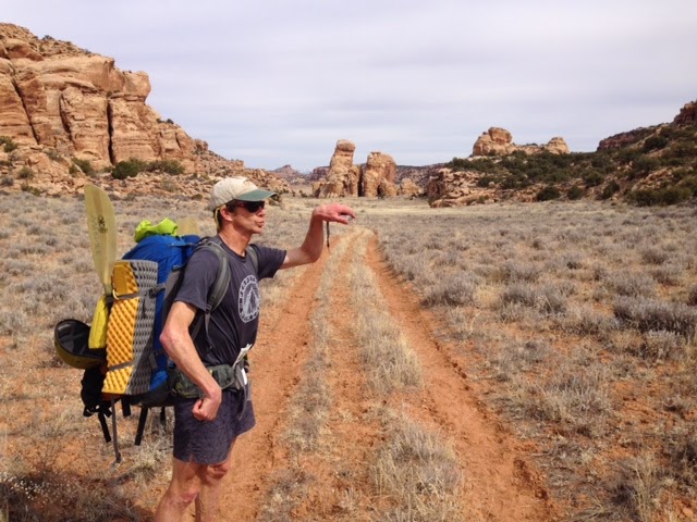
But back to the trip. We went up and over Elephant Hill (that Ash and I had traversed a month ago on our bikes, and again I marveled at the four-wheelers who are bold enough to drive over that) and then headed down Red Canyon, for a 10 mile total hike to the river. I thought at one point we had gotten to the river, but there was a slight problem with it:
But eventually we plunged down a deep canyon:
And found the drainage that seemed more appropriate for floating a boat:
Immediately we both realized how much we've missed being on the water; living in the desert makes it tough to get on rivers very consistently, and all it takes is a few paddle strokes to reinvigorate the stoke.
 |
| Tom bobbing along merrily |
The beta that we had was that there was a viable exit from the canyon in a break in the canyon walls a mile below the Big Drops, and after a long day - that had started in SLC that morning- we were happy to see a great little beach camp right at the base of what looked like the ramp out. We had a nice fire - that, yes sir, was in our fire pan, Sir! - and were lulled to sleep by the mellow roar - if that's not an oxymoron - of the rapid out our "door".
In the morning we rolled up the boats and started the haul out of the canyon. The chute that we climbed was probably something along the lines of 1500 feet of 3rd class at probably 30 degrees, and coming off of ski season, we both had the great thought that it would be a killer line to ski once it "fills in!"
Once up on the mesa we navigated our way cross-country to the bottom of the Imperial Valley, which - according to our maps, which were mostly accurate - had a faint double track in it, and we commenced our long slog back towards our start.
And it was nice that the scenery kept improving from austere to sublime as we went:
And we kept ourselves entertained
After hiking most of the day we got to the entrance to the fabled Chesler Park, where we were able to go off the sandy doubletrack and onto the nice park trails, and the views got pretty nutty:
We finally saw a few folks in popular Chesler Park, and they rightly wondered what the hell we were doing with kayak paddles when there didn't seem to be water....anywhere
We decided to camp for the night in Chesler Park just a few miles shy of the trailhead, since it was so amazing out there, and I had to try try out my new Scrabble "board' that I had hauled the entire way:
 |
| Cotton! doubles as a napkin or wash rag, not that I ever actually use either of those! But nice and light. Thanks JD! |
And a quick jaunt out in the morning brought us back to the trailhead. here's a map of the route:
 |
| the yellow is our hiking route; we put in just below the confluence. |
 |
| a bit more detail |
Thanks again to Tom for having the idea and keeping it alive. And now he's cooking up another variation that's about 5x the distance and also includes mountain bikes.....that'll be another tale fo sho.


No comments:
Post a Comment