Thursday, December 29, 2016

The Bear's Ears National Monument

Well, it happened:  President Obama created the Bear’s Ears National Monument yesterday!  For us bleeding heart lib’ral extremist  tree huggin, granola-eatin’ wackos we heartily raised our too-expensive locally-brewed craft ales in a toast to this needed move.  Despite the threats and cajoling from the likes of Utah Governor Gary Herbert, Senators Hatch and Lee, and representatives Bishop and Chaffetz, Obama correctly saw through the haze of bullshit-slinging and did the right thing. 

Far smarter people have and will write about this monumental monument designation – including the indefatigable Brian Maffly of the Salt Lake Tribune who had the lead story, and the description of what the monument includes in the paper today (fortunately he only barely mentioned how awesome the canyoneering is in that area, and didn't mention at all the great pack rafting and bike touring there!).    But I feel qualified to opine, because….well, I live in Utah, I’ve visited these areas, and I help pay our elected officials’ salaries!

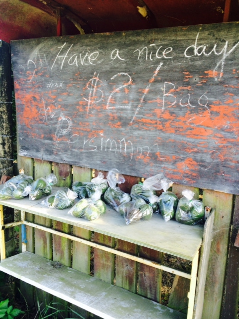
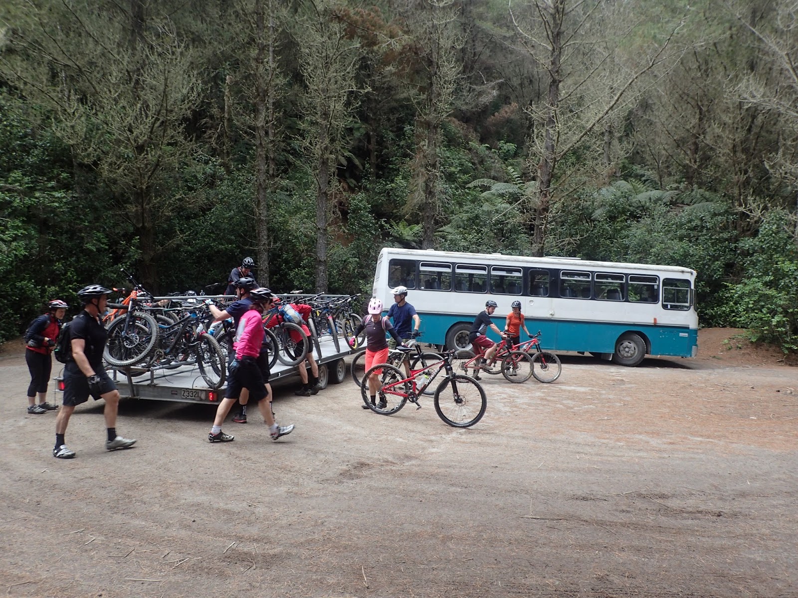
This past summer I wrote an article about bike touring in the nearby Grand Staircase Escalante national monument for the Utah Adventure Journal.  We didn’t necessarily go there to analyze the economic and social impacts of national monument designation 20 years after President Clinton’s creation (we just wanted to do a nice, rugged, beautiful tour!) but given the push to create the same for the Bear’s Ears area it was impossible to ignore the effects on the GSENM given the Sky Did Fall (on GSENM) and The Sky Will Fall (on Bear’s Ears) cries from Utah’s politicos.  I won’t re-create that article here, but fundamentally my point was thus:  our extensive bike-saddle research indicated to us that monument designation has been an economic boon to that region due to dramatically-increased tourism, and the wails of the cattle grazing and mining industries of economic failure have been misleading at best and outright lies at worst.

Many, many moons ago, in one of his earliest childhood memories, my dad remembered sitting on the steps of his house in a small town in central Kansas listening to my grandfather and his friends talk business while smoking cigars and watching the long sunset over the fields of the Midwest plains.  My grandfather owned a bridle factory, and at one point he memorably declared “The tractor will NEVER replace the horse!” for some important technical agrarian reasons that my dad didn’t remember.  It is a tangential story that is reminiscent of what Utah politicians seem to keep saying in Utah and elsewhere:  “Solar power will NEVER replace coal!” and "Cattle grazing is an integral part of our economy!".  Ultimately, I don’t think that the US government – nor anyone else – ultimately saved the bridle industry.  So why should we continue to subsidize and support the grazing and extractive industries? 

First, grazing.  According to the BLM’s grazing website, the 2016 fee for grazing a cow and a calf on federal lands is $2.15 per month, or $25/year.  Interestingly, the fee started with a base value of $1.66 or $19.92 per cow/calf per year…..in 1966!  I’m no economist, but jacking the rates $5 over 50 years  is a pretty good deal for cattle owners!  And – like the Grand Staircase – grazing allotments will be grandfathered in, and in the GSENM 96% of the original allotments that existed in 1996 still exist today!   In the meantime, the Grand Canyon Trust has tried to buy out rancher’s grazing rights to retire them, but they have almost no value because….there’s no grass left because of over-grazing!   All of which also applies to the Bear’s Ears, so deep cattle grazing losses are a misperception.    

Natural resource extraction:  No one who puts gas in their car needs to be told that energy prices are low.  The price of natural gas – which may or may not exist in the Bear’s Ears area – has been notoriously fickle: 


And anyone who has been to Vernal, UT, SW Wyoming, North Dakota, etc will tell you that their boomtime economies of just a few years ago have completely dried up.  And it’s not like a seasonal job (typically associated with tourist-based economies): those jobs don’t come back until the prices rise.    And coal is in the same boat:  despite the future leader of the Trump Nation’s boasts, coal as we know it ain’t comin’ back.  Here’s the price graph:

And even if it did, automation has made the typical coal miner job somewhat obsolete (and a good thing too; NPR had a depressing story last week about the proliferation of the deadly Black Lung Disease in coal country).

Since Orrin and company have been the most vociferous opponents of BENM designation, I thought I’d take some of their other complaints one by one. 

Jason Chaffetz:  “The midnight monument is a slap in the face to the people of Utah.  Actually, contrary to Clinton’s truly surprise announcement, this has been in the works for months, and in October Secretary of the Interior Sally Jewel was in Utah for 5 days talking to members of all the leaders and constituencies about the implications of monument designation.  Ironically, Chaffetz himself and fellow UT congressman Rob Bishop created their Public Lands Initiative bill last spring specifically to try to subvert national monument designation (it didn't come to the fore in the most recent congress), so it’s a stretch to insinuate that this was a desperate, last minute gesture.  And over 50% of Utahns support national monument designation. 

Orrin Hatch: 
With this astonishing and egregious abuse of executive power…” – As Orrin himself knows very well after being in office since nineteen hundred and seventy six, the Antiquities Act has been used over 100 times since Republican president Teddy Roosevelt came up with it, including some by those nutty preservationists like George W Bush, Ronald Reagan, Richard Nixon, and George HW Bush. 

The President's proposal, like so many others, goes well beyond the original authorities of the Antiquities Act, which was intended to give presidents only limited power to designate special landmarks, such as a unique natural arch or the site of old cliff dwellings.”

Again, according to Wikipedia:  The first use of the Act protected a large geographic feature – President Roosevelt proclaimed Devils Tower National Monument on September 24, 1906. President Roosevelt also used it to create the Grand Canyon National Monument – the first step in protecting that place of great historic and scientific interests.”  Anyone who has read one bit of information about Teddy Roosevelt knows that he was all about preserving large swaths of land.  

Senator Mike Lee:  "This arrogant act by a lame duck president will not stand. I will work tirelessly with Congress and the incoming Trump administration to honor the will of the people of Utah and undo this designation."  Mike Lee calling Obama "Arrogant?!!?"  Now that's calling the kettle black!  Again, according to  Wiki:  The United States Supreme Court has repeatedly upheld presidential proclamations under the Antiquities Act, ruling each time that the Act gives the president nearly-unfettered discretion as to the nature of the object to be protected and the size of the area reserve.”  That said, a super scary possibility is that Mike Lee (and his brother) is/was/were/are supposedly on Sir Trump's list of potential Supreme Court justices, though that probably waned when Lee said he voted for Gary Johnson.....but even so, Trump may/will be nominating a new justice regardless  (unless Obama really wants to be bold and do a full appointment during the Congressional recess, which - according to Robert Reich - is not only possible, it has precedent) 

Utah Governor Gary Herbert, in an interview with Ari Shapiro today, said that one of the county commissioners  - by congressional demand – must be a Native, and that Native doesn’t support monument designation, therefore the native population doesn’t support it. However, this guy: David Filfred, Navajo Nation Council Delegate representing Aneth, Teec Nos Pos, Red Mesa and Mexican Water Chapters in Utah was quoted today: “We are grateful for President Obama's brave action today. For the first time in history, a president has used the Antiquities Act to honor the request of Tribal Nations to protect our sacred sites. In doing so, he has given the opportunity for all Americans to come together and heal."  To be honest, my sum total experience with the SW Native population has been gleaned from a few Tony Hillerman novels, but most news accounts I’ve read indicate that there are a few standout individuals who oppose the monument, but entire tribes support it, since the entire intent is to “preserve antiquities” (though it’s understandable if the Native population is suspicious of the integrity of big federal agreements). 

Another meaningless quote by Herbert:  "By unilaterally locking up 1.35 million acres — an area roughly the size of the entire State of Delaware......"  Who cares? Delaware is tiny and inconsequential!  Utah also has counties with no residents that are as big as Delaware, and no one cares!  

Seeing so much blind support from our politicians for good ol’ boy ranchers and executives in the extractive energy businesses when places like Moab, Kanab, and Escalante are clearly prospering from the burgeoning tourist industry associated with national monument designation is frustrating at best.  Therefore, we granola eaters are stoked that Obama took the bold move: 
thanks to Pat Bagley of the SL Trib for - yet again - absolutely nailing it.  


We’re gonna miss that guy. 

thanks so much to Patagonia and Yvon Chouinard for their tireless support for this, to Sally Jewell for handling it so professionally, and the many others who devoted time and money to this important project. I regrettably donated neither, and I'm glad that it was successful despite my lack of "real" support. 


Sunday, November 20, 2016

Dispatches from New Zealand

When I graduated from college I went for a big European bike tour and returned home from Portland pretty broke and needed to work for a while.  At about the time I got home a coupla good friends headed off on a bike tour of New Zealand, but due to the aforementioned financial issues, I couldn't join them.  A few years later I also had a friend who was going on a bike tour in NZ and wanted me to join him, but I couldn't afford the 3 weeks of vacation.  Some years later my 75-ish year old mom went to New Zealand, and....well, tearing around NZ with her probably wasn't appropriate.  About 15 years ago Ashley went to NZ for a bike tour and....I wasn't invited!  Which is not quite true; she was doing the trip with her great friend Audrey and I probably coulda horned in, but I was getting going on a new biz and it wasn't a good time.  Then I met Kiwi Andy, who had moved to Utah and became one of my best kayaking pards, and then he moved back, so I had yet another good reason to go.  and finally, And, our good friends the Southwicks were so bold as to actually pick up their family and move their entire life from SLC to a beautiful town on the north end of the south island, so we had yet another great reason to go.  But other adventures beckoned and still I didn't make it, even as Andy has kept coming back to visit us.  But this past spring when I gave my gratuitous "I really want to come down there" he just scoffed at me:  "you've been saying that for years.  You're not coming down!"  Of course, I was offended, but it was true.   But events have come together, and finally....after far too many years and opportunities, I'm in New Zealand!

One of the things that has kept me going other places is that NZ represents somewhat of a lack of the buzz of "travel adventure"; yes, it's far away and there are a zillion lifetimes-worth of adventures to be had, but in terms of exposure to a radically different culture ala many of the trips that Ash and I have taken to Vietnam, Peru, Japan, Italy, Bulgaria, and others New Zealand is....very similar to the US.  It even looks a lot like Oregon; at least, so far (albeit with lots of different plants, that in total provide a similarly-verdant landscape).  But then again, I charge all over the US looking for good adventures, and they are all very US-like, so why not go to NZ to get some great adventurin' in with a great pard and partake in their culture?  

And though I had no idea that I would need it when I booked the flights a couple of months ago, after the gut-wrenching election, it's nice to be slightly away from that (though all the Kiwis are keen to hear my thoughts....)

Andy lives in Tauranga, which is a few hundred km south and east of Auckland on the coast (of the north island).  As mentioned above, it looks like Oregon, but they grow avocados, passionfruits, and citrus here!
Avocados for $2/bag, and they STILL wish me to "have a nice day?!"  I love the Kiwis....

"Rocket Lettuce"  - a far better name than "Arugula!"


My first experience with the legendary Kiwi niceness was in the Auckland airport; as I was getting ready to board my flight I asked the ticket agent if I could bring my bottle of water through security, and she said "well, this IS security, and I think it's fine if you want to drink some water!"  Hear hear!

One of the primary reasons for coming to NZ was to paddle the rivers, and if the first coupla days are any indication, they live up to their reputation.  So far we've paddled the Kaituna and Wairoa rivers; both dam release runs that are short (1km and 5km respectively) but offer a surprising number of pretty incredible quality rapids in their short span.  I didn't take my camera down the Kaituna, but here are a coupla pics I poached off the web:

I haven't paddled anything with significant gradient for a few years, so it is taken me a little to get back into the swing of things.  I flipped the first two times running the waterfall in the pic above until I realized that I wasn't quite on line; on our third lap I was able to appreciate the view with my eyes above the surface rather than below.

Paddling such a cool run (reminiscent of the White Salmon in Washington, but with warm water and a gradient sorta in between the BZ run and the Farmlands run) would be a great day in an of itself, but this river happens to drain Lake Rotorua, and I had heard about the mountain biking in Rotorua.  It bills itself as "The Best Mountain Biking in The World".  Hmm.  Really?  A bold statement.  But of course, after 3 laps on the Kaituna I had to see this for myself.

Andy and I were joined on our ride by Kylie, who knows the trails there perfectly and had also been showing me the lines on the Kaituna (she warned that she was not "bike fit", but it was clear pretty quickly that fitness doesn't have too much bearing on how much brake you grab on descents, and for her it wasn't much!).  I am never, ever prone to superlatives, but I must admit that it's the Best Mountain Biking Ever!   An area as big as Portland's Forest Park, with "heaps" (a common Kiwi term) of ridonculous singletrack; every trail is pretty much the best "flow trail" I've ever done!  (with a few more roots thrown in).   It was so much fun that we ended up riding nearly 5 hours, and there are many trails that we didn't do.
that grin is well-warranted


It was a good example to me of what can be done with proper management: this area has mt bike-only trails, pedestrian-only trails, horse-only trails, and shared use trails, with clear, concise, and descriptive (ie length, vertical) signage on all.  There's a shuttle that runs up and down the mountain that cyclists and peds both use:
I was a bit horrified by this, but the system is so vast that it seems to simply absorb people into the woods
and there's even a water station:

something that would be much-appreciated in the arid Wasatch (and in Forest Park and many other US parks as well for that matter!).

JC joined us mid-ride (he'd also been on the Kaituna) and was showing us all how to truly flow - at high speed - down the trails:
 and on one climb that traversed up through a big clear cut I said something about "too bad about the logging" and he said: "Well, we all need paper, this is second growth anyway, they rebuild the trails after they log, there's much more forest here than there is logged terrain, and we get a nice view when there are no trees!"  Those Kiwis, looking on the bright side.

We also met Reginald:
"Um, I gotta tell you, that's a HUGE lens you have there, Reg...."
who is an avid birder/photographer and was there shooting a pair of New Zealand falcons:
from wikipedia, but Reginald had some comparable pics
That are quite similar to our peregrines in size and flying ability.  We were a couple hundred yards (across a clear cut, which apparently the falcons prefer; another reason that logging is good?) from a couple who brought a dog up on their hike, and we had a good laugh watching the falcons dive bomb the threesome; they had to grab a big branch to fend the falcon off and ran down into the woods to escape the falcon's wrath!  There were signs saying "don't bother the falcons" but it was clear to us that they can handle themselves.
if our day riding in Rotorua is any indication of what's to come, they didn't even include it in this book??!  
The Wairoa is another coastal river that was almost denied to paddlers due to a dam, but local paddlers rallied to ensure 26 releases every year....in 1976!   And it's another gem: really high quality, lowish-volume class 4+ river that's only 20 minutes from Andy's house.  His "mates" asked me how far I had to drive from SLC to get something like that, and were horrified when I said "seven hours!"
Again, I needed to get my low-volume gain on, and realized that my water-reading and boofing skills were a little rusty, but despite a coupla flips all went well.  Here are some good pics poached from the interwebs:

I missed the boof stroke here and went for a bit of a ride

I flipped once right about where this guy is; exciting time to roll!

I came a bit close to going into "the toaster" to the looker's left there....
Andy perfectly executing a boof stroke
Ash has said that she likes to put on a river and leave the car and the shuttles for three days at a time; in this case, we did the river three times in a day!  Exactly the same only completely different.  But along the shuttle route is a nice cafe, so we had ourselves a very civilized midday break in the action:
It was great to reconnect with Bruce (glasses), who was on the Rio Maranon trip in Peru last year 
I was also out for a nice road run this morn (while Andy was watching NZ's "All Blacks" national rugby team take on Ireland); I haven't done an exclusive road run for many years, but with roads like this:


It makes it quite tolerable!

So far New Zealand is living up to its billing fo sho.  The next adventures that await are a day of canyoneering (far different from Utah canyoneering:  there's running water!) and then a 3 day sea kayak around the Coromandel peninsula, and will throw up another dispatch.

Tuesday, November 15, 2016

"Satadark" - A bigger Cataract Canyon Pack Raft Loop


A year and a half ago I did a great weekend-long pack raft trip in Cataract Canyon with Tom Macfarlane where we started at Elephant Hill (the end of the road in Canyonlands National Park's Needles district), hiked down Red Canyon, floated the river to an unnamed exit point, and hiked back.  Really great trip that I chronicled here.  While on that trip Tom mentioned that he had been doing some research on a bigger trip that also incorporated Salt Creek and Dark Canyon and would involve mountain bikes as well, and my interest was piqued.  Time rolled on and we talked about doing this trip and identified late October as the period to give this a go, and in the meantime I had told some of my pack raft pards about the trip, and it started to come together.

The logistics of Tom's adventure were a little daunting:

  • leave boats and food at the Needles visitor's center
  • drive 17 miles up to the trailhead for Salt Creek
  • leave boatless packs there
  • drive 17 more miles up to the Dark Canyon trailhead and leave car there
  • ride bikes back down to the Salt Creek trailhead
  • leave bikes, pick up packs, and hike down Salt Creek 28ish miles to the main road
  • pick up boats and food, go down lower Salt Creek about 6 miles to the Colorado river
  • float 38ish miles down the river to Dark Canyon
  • hike 25-30 miles up Dark Canyon back up to the car
  • pick up bikes from the Salt Creek trailhead on the way out
  • Try not to leave behind any critical gear behind at each transition!
A little contrived, but not bad, and it's a fun opportunity to throw three activities together.  Here's an overview map:

As it turned out, the schedules were a bit off, so Tom and our good friend Colter were going to be doing a shorter variation of the trip ahead of us, and our crew morphed into four.

I bumped into Matt Clevenger at the Utah Avy Center's party and the first thing he said was "dude I REALLY want to get into pack rafting!  I don't really hike and I don't paddle, but I can take abuse and I'm super keen!"  And indeed, Matt had been pretty badly Diegelized once before; he triggered an avalanche crossing a slope - that I chose - and was buried quite deeply in the debris, but we were able to get him out, probably not long before he slipped away.  So I was a bit flattered that Matt was willing to do another adventure with me!  

Jon Jamieson has been a great friend for many years and my pack rafting tales had gotten him intrigued, and when I had told him about this idea a long time ago he said "I'm in", and I knew that he was.  And Greg Hanlon (aka "Captain America" as he's known in New England) has been my partner on innumerable dumb and exciting adventures.  And a special addition was Greg's brother Chris, who was going to join us in the first couple of stages of our triathlon.

Our first stop was the Needles ranger station. I had talked to a former Needles ranger who is now stationed in Moab and he was not only very helpful but also pretty excited for us and our trip.  When we got to the Needles district we talked to the ranger on duty to get our permit, and he was a completely nice, earnest guy who was also keenly interested in our idea.  However, when I told him the plan he said "You can't pack raft Cataract!  That's class 5 whitewater!"  What I thought and what I said in response to that were two different things:  What I thought was "don't tell me what I 'can' and 'can't' do!" but I'm learning  - ever so slowly - so what I said was "oh that's right; what do you suggest we do instead?"  He would have doubly freaked if I'd told him not only were we doing Cataract - which is what our too-expensive permit was for - but we were also doing it with a complete rookie on our team!   

The first of our Gear Explosions was in the parking lot of the visitors' center:

and then we had another where we left Chris's truck, at the Needles road:

our third at the Salt Canyon trailhead:
The next at the Dark Canyon trailhead:
and finally we were off!
We had done a hike that day in Chesler Park to "kill some time" and then got a bit concerned about running out of daylight for our ride back, but it was a zippy ride with some great views of Cathedral Butte

And Salt Canyon.
Apparently the Bud Light litterbugs had also made the journey from the Escalante area to the Salt Creek area....

We camped at the trailhead, and the next morn we left our bikes, donned the packs:
and headed into Salt Canyon.  

I'd never really heard of Salt Canyon, but a little bit of research quickly indicated that it is pretty special:  beautiful canyon country, tons of arches, and absolutely polluted with Native American ruins.
The ranger had told us there were a lot of ruins and I asked "where?" but he only smiled and said "you'll find them, if you are looking".  As we traversed the broad Salt Creek valley:
We thought "if we were natives in these parts we'd probably be using this valley to grow stuff too" and pretty much every major alcove had ruins in them. 

The pot shard (is that one word? potshard?) collections were impressive:


And there were other remnants too:
I don't think corn cobs compost that well...


Including this:
I would call an 800 year old melon plant "heirloom" for sure!
There was also a pretty stunning piece of rock art that we'd never heard of, but later we found out it's famous:  The "All American Man"
Captain America ponders the All America Man
Though apparently, its origins are a bit controversial, according to this article.  

Matt tried to see if he could be as good of a climber as the Anasazis:


Dorks:
The arches were all over the place:

Salt Creek is apparently so popular that not only is it permitted, but you also have to apply for certain campsites on certain days.  We took a bit of liberty with that, and camped in the wash:
Not too far from Nutty Buddy rock:
the rangers make you take bear cannisters into Salt Creek, which we thought was stupid, until we saw this track...

Salt Creek was running, which despite the fact that we were in there in late Oct, felt great to cool off in the pools:

And frolic gaily:
Salt Creek was an ATV route until the mid-90's when the park management made the controversial decision to close it to ATV use, and in a good example of how even the desert can heal itself, the trail had "deteriorated" to a nice singletrack
When we got to the Peekaboo arch area the trail took us up:
and over slickrock a few miles to the Squaw Flat campground in Needles.  It was cool to get into the slickrock that we'd been looking up into for the last coupla days

and of course, men being...boys, in canyon country, I had to try to be funny:
Back down at Squaw Flat we grabbed Chris's rig and drove over to the trailhead where people go to hike out to the confluence (of the Green and Colorado rivers) overlook, and had another gear explosion:
 Below the highway Salt Creek goes over a thing called "Lower Jump" which is a 120 foot pourover, that I was told has no rappel anchors and if we did set up an anchor and leave a big rope there (so as to not carry it for the rest of the trip) rangers would find and confiscate it to avoid other joeys trying to do the same thing.  So we had to find an alternate route down into Lower Salt Creek, and the Big Springs and adjacent Little Big Springs looked viable on Google Earth. However, we got about a hundred feet into Big Springs and came to about a 60 foot drop, so we trudged back out and tried Little Big Springs, which turned out to be fine, albeit a bit of a thrash. 

Down in Salt Creek we camped in the wash:
And using the creek water had a nice dinner of freeze dried meals.  Afterwards we made a bit of evening tea, and anti-beverage boy Greg decided to partake (a little) and said "it's not very good".  I gave him some shit about being too much of an anti-beverage zealot: "'c'mon...it's mint tea!" until I took a sip myself; at some point after leaving the creek a few miles above and getting back down to it "Salt Creek" actually lived up to its name! 

Below Big Springs Salt Creek offered up a bit of canyoneering:
a fixed line


an anchor for a short rappel; we had brought one harness, a long throw rope, and a fair bit of webbing in anticipation of this possibility. 
And finally hit the river!
another gear explosion
Matt getting ready to christen his boat

Christened!
We paddled a few miles down to Spanish Bottom and then hiked up the thousand-plus feet to the magical Doll House:


The Doll House has plenty of opportunities for adventure, from tight slots:
To fun climbs
And cool formations
Look familiar?

Greg challenging the rock to "who's got the biggest nose"
and going nose to nose on it....

 with great views.

And after a night spiced up with Ringtail cats and a skunk rifling through my food, we hit the river, with the first rapids around the corner
We laugh at Danger!
At low water the rapids are mostly class 2-3, but the waves are big and messy, and can toss a pack raft around a little
Greg lining up
 Here's Matt in one of his first-ever rapids
 I had told Matt that he'd be "fine", and I don't like to sandbag folks much, and  - like he said - he can take a beating well.  Once on the water I realized that Matt didn't really know a river eddy from Eddy the Eagle, so we pretty much tried to make him into a water-reading expert on the fly.  And he did great!  He very much took to heart our most important advice:  when in doubt, paddle hard!

JJ also paddling hard....

'cause he needed it to punch the hole!  
The Big Drops (Big Drop 1, 2 and 3) are a bit of a step up from the others, are near the end of the section, and get progressively bigger, with BD 3 being infamous at high water.  We were at basal flow, but it still had some impressive features and provided a good challenge
the left line

JJ stylin' the left line

me in the left-of-center line
And had a great riverside camp

native boy pondering the endlessness of time
Soon enough we reached Dark Canyon, for another Gear Explosion
And started the long haul out of Dark Canyon.  It was beautiful and as such made for some slow hiking


Including one spot where we had to backtrack a half mile to do a 4th class climb a few hundred feet to get out of a gorge
I kept seeing a pair of footprints, and knew that Colter and Tom had preceeded us by a coupla days:
Shoe Geek that I am, I recognized this as the Patagonia Rover, and only Colter would be hefting a heavy pack wearing pretty minimal shoes!  I also saw Tom's Hoka prints. 
We thought that Dark Canyon was 25 miles long, but we all - and Tom and Colter - felt that it was longer than that, tho maybe "hiking" like this
not only was slow, but had potential for issues:

But we were able to get some respite from the drudgery
by cavorting gaily, 

and we bumped into some locals:
We anticipated that water would be an issue in Dark Canyon; we had gotten the beta that after this nice spring
coming out of Youngs Canyon it would get pretty dry, and sure enough, it did:
But the rain of 10 days prior had created a few puddles, which we were able to survive on
And again camped in the wash, assuming our great stable weather would hold
ironically, about 20 minutes after we starting hiking the next morning, it started to rain....
And after a half day, a full day, and another half day we found ourselves back up at 8000 feet, high above the river
However, our adventure was not over.  The temp had plunged to the mid-40's the wind was gusting, and it was spitting rain as we loaded back into Matt's car, and we knew that real rain could be a big deal on the clay roads.  The trailhead was about 400 feet below the mesa rim so we had to at least get up to the mesa before the road got wet, and sure enough right as we topped out it started to rain in earnest.  At that point it was mostly downhill all the way back to the highway, but as anticipated the goo started to build and the car became nearly uncontrollable as we greased around.  Our ebullience at finishing the trip was held in check as Matt deftly muscled the steering wheel around trying to keep us from both the gooey ditch and the big drop offs into Salt Canyon, and we hustled at the trailhead throwing bikes back onto the car.  Fortunately the road surface got more gravelly, and even as it continued to rain we were able to escape.  And we needed to; we had all eaten our last food, and Matt's stashed potato chips were a distant memory, so as it was we were bonking sitting in car as we hit Moab!  

Thanks again to Tom Mac for the great idea, and sorry I couldn't have enjoyed it with he and Colter, but thanks again to Matt, Greg, and JJ for being great pards on an incredible trip.  These little pack raft things open up the opportunity for all sorts of silly adventures.  

If you haven't gotten enough pics of this already, check out Matt's great (better, really, despite the fact that I got a new camera and Matt's used his Iphone 7!) pictures here