
Back in April I had the good fortune of being invited to paddle the Jarbidge/Bruneau river by Mike Curiak, who also had talked a couple of wacky Alaskans to come down south for an early season run, and after a couple of days of paddling with Roman Dial and Brad Meiklejohn they mentioned that they were planning on early-summer packraft trip in the Arctic National Wildlife Refuge that would include the legendary Firth river , which is as well known for the huge expense (due to only-expensive planes that fly into the put in and takeout; a commercial raft trip is $11k!) as for the quality of the river (which is high). Was I interested in joining them? I pretty much said "Let me think about that. Yes, I'm in!" With the record-big snowpack all over the West - and the first in California in years - I knew that an AK trip that could be done any year may preclude some other unusual adventures, but the opportunity to gallivant around the Arctic for a coupla weeks with some super experienced travelers whom I had met and liked a lot was too great to pass up, and I told them that I hoped their invite wasn't coming lightly, because I was in. And thus I found myself bound for the Arctic in mid-June.
 |
| Of course, any sunny day you fly from Anchorage to Fairbanks it's worth a glimpse at Denali. |
 |
| for reference, you can see Fairbanks on the lower left, the US/Canada border is at the yellow/white line, and the northern "border" is the Beaufort Sea section of the Arctic Ocean |
 |
| Here's how much the Refuge takes up of that area |
 |
The idea was to start on a tributary to the Firth, go down that to the river, float the Firth's fun rapidy section for a few days to about where it started to flatten out, go up out of that drainage to the next river to the west (the Malcolm) and hike up that and then up and over to the next drainage which happened to be the fairly commonly rafted) Kongakut river, float that for a bit then climb up and out of that to the next one (the relatively short-drainaged and awkwardly-named Egakserak), float/walk that down again almost to the flats, then up and over to the (bigger, glacial-fed) Jago river, which would then whisk us 40+ miles through the flats to the ocean and -importantly - deposit us fairly close to a village called Kaktovik that had daily commercial flights to Fairbanks and Prudhoe Bay. So a lot of hiking, and a lot of boating!
After flights to Anchorage, Fairbanks, Arctic Village (that's more in the Yukon area) we hooked up with Kirk Sweetsir, who has been flying around the Arctic for over 30 years.


We jammed ourselves and our gear (and a spare bear barrel full of extra food that Kirk was to deliver to our midway point on the Kongakut) into his plane and were stoked:
 |
| Roman is the good looking one without the boogers. |
As with our trip to the south 9and way west) side of the Brooks Range a few years ago, I got a pretty good buzz watching Kirk fly off and feeling a bit of the weight of how "out there" we were and that it was going to be a couple of weeks of solid adventuring ahead!
Very quickly we mounted up on the "Aufeis" that I had heard about but had a hard time understanding. Basically, it's a German word that means "Ice on top" that forms in arctic river valleys as a function of groundwater upwelling or river flooding in really cold temps, but because it's ice it takes longer than snow to melt (why it's a German word when it only happens in arctic climes....unknown!). In any case, it makes for a good walking surface when it softens in the 24 hour sun:
 |
| a little slushy, but not bad.... |
Within the first hour Brad had found a rare artifact:
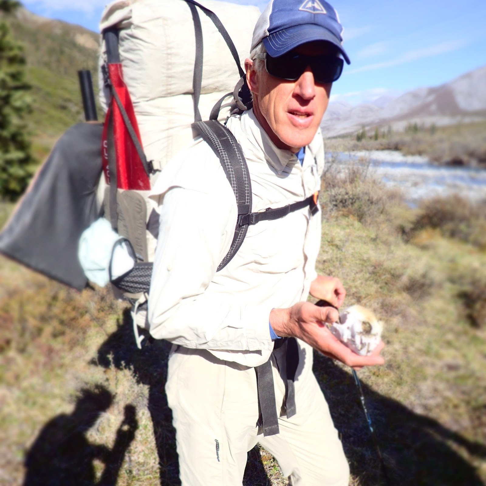 |
| A wolverine skull! not only did he find it, but he toted it for the rest of the two weeks and actually kept it intact! |
shortly thereafter he found another example of arctic wildlife:
 |
| this caribou antler is a little harder to packraft with! |
An important note: Brad has been exploring this area for 25 years, and on the first day when I made my first - and only - reference to "ANWR" - he quickly - but gently - corrected me, pointing out that politicians and oil developers who were generally against the "Wildlife Refuge" part of the Arctic National Wildlife Refuge were the ones who promoted the military-esque acronym of ANWR, and if there was to be any abbreviating going on it was to be "Arctic Refuge". A great point, and duly noted.
Our first camp was along the nearly-dry Joe Creek

But by the next morning enough water had come in from tributaries that we at least were able to get our food-and-boat-laden packs off our shoulders and into the water
 |
| In packraft parlance: "Walking the Dog" |
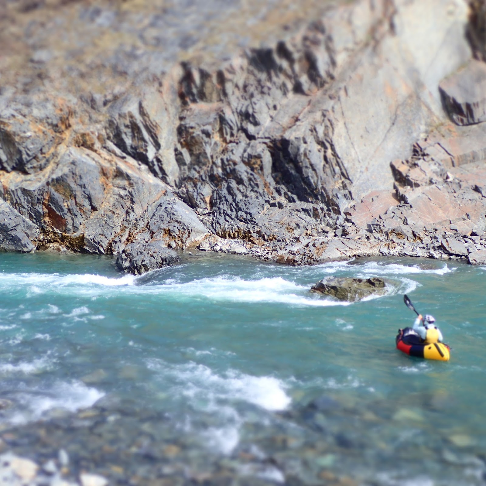
And soon enough we were actually floating

In the winter the Aufeis covers the entire streambeds, and then gradually melts back during the summer, but there are still lots of bridges and tunnels. We found one that was dumb but appealing:
 |
| Roman seeing if it'll go |
 |
| Brad wisely having no part of it |
 |
| Roman going in |
it was super cool under there with the blue light of glacial-type ice, but later that day as we were portaging another that wasn't quite high enough to go under it suddenly collapsed into the creek with a roar, and Roman and I vowed not to indulge ourselves with going sub-aufeis again!
The aufeis patches actually had little creeklets running across them;

and when the way was blocked it didn't really slow us down much

 |
| distances always seem far in the arctic. |
Soon enough we had our first evidence of actual living creatures:
 |
| bears and wolves doing a dance? |
 |
| big doggie |
And not long afterwards we saw our first grizz, from a nice comfortable half mile or so away, and it either didn't see/smell us or wasn't interested. However, that was that bear....
As we floated on down we got more and more water and were able to actually stay in our boats and paddle with current, and at one point I realized that the water got noticeably deeper, as if there was a dam downstream of us. Sure enough, we came around a corner and there was a small dam; about the size of a beaver dam but not made by beavers. We floated to the lip of it on the left side of the river and one by one did an easy portage of it, got in our boats, and floated away. I was last, and just as I looked up from putting my spray skirt on I caught a glimpse of movement out of the corner of my eye and spun my head to see two bears: one smallish and blonde, standing up on its hind legs, and the other brown, big, and.....charging across the ice and scrambling down to the shore towards me.
I yowled like a banshee and instinctively decided that the little anemic creek was my best opportunity for escape, even as it took me a bit closer to the bear. The momma got to the edge of the aufeis and swung her head back and forth, clearly deciding whether or not to leap last 6 or so feet into the water and come get me, and I was close enough to see saliva swinging out of her mouth. Packrafts aren't known for their speed, but I think mine pretty much got up on a hydrofoil plane as I stroked away, not daring to look back but also not hearing a gigantic splash. In the meantime, Brad and Roman hadn't seen the bears but heard me yowling and were trying to figure out why I came blasting around the corner with eyes as big as saucers but got it that something was amiss so we all paddled like mad and apparently left them behind, but not comfortably given that the aufeis and adjacent tundra was as easy-traveling as the creek.
I was still buzzing hard an hour later as I kept thinking about how it was literally a matter of seconds that all three of us were still bumbling on the dam and the bears hadn't quite seen us yet. It would have been a bad deal.
At camp that night the low spruce trees were rubbed bare and had lots of bear fur from them scratching a scritch, making Brad and Roman comment that it felt "beary", and Roman had the idea to hang up his boat to "make us look big"
 |
| the bear fur is the flock-looking stuff. |
but it was a nice camp with the Firth nearby


and the "night" (there is none at 70 degrees north at the solstice) passed by without incident.
And finally we were on the Firth, which had its share of aufeis


and we had bear sighting number 4:
 |
| a bit blurry, but I was in a hurry with the camera. This guy was just interested enough in us to stand up and give us the impressive view of his whole stature, but then came down and ambled away. |
soon enough the aufeis gave way to classic tundra

with some pretty decent class 3+/4- rapids

the river entered a shallow gorge that was maintained for about 30 miles

and we had a memorable camp on the edge of the gorge

 |
| some nice flowers clinging to cliffs |
 |
| a cool mosaic of colorful rock shards on the bank |
We surprised a moose getting a drink, and were horrified to watch him go straight up out of the gorge on a 50 degree slope waiting for him to lose it and tumble with broken legs back down into the river
 |
| moose is in the middle of the pic, kicking down all sorts of debris |
But he made it, much to the relief of all.
We had more fun rapids:
and a bit of flatwater

 |
| Only Roman Dial would have the weight of his pfd written on it with a sharpie.... |
The Firth is not without some civilization; at Sheep Creek there is a Northern Yukan National Park (Canada) building and a lodge that people fly into. Now we would never break any park rules and have a fire to warm ourselves against the wind blowing in off the Arctic Ocean and cook our meals, but if we had, we might have been worried about this plane seeing smoke from the imaginary fire:

We had some visitors across the river:
 |
| I expected to see gigantic herds of caribou thundering across the tundra, but the most we ever saw at any time was about 20. |
and as the Firth's rapids began to wane and the flats loomed off in the distance,

we rolled up the boats and slung the loads onto our backs for the long grind out of the Firth drainage


Eventually we got high enough that I got my first view of the ice pack of the Arctic Ocean, way off in the distance

and onward we trudged

though it actually wasn't that far to the Malcolm river

and Brad pointed out a good example of permafrost:
 |
| it usually is just muddy ice. |
And a nice camp en route:


The Malcolm didn't have too much water, even if we had been going the right way on it;

but the tundra made for good walkin'


And then we had our "real" bear incident.....that made my earlier encounter seem pretty mild in comparison. But this post is long enough for now, so that'll be in part 2.
No comments:
Post a Comment