Even though I had just returned from a great pack raft trip to AK, it doesn't take too many days in sizzlin' Salt Lake in July to get a quick yen to head back north and into the mountains. So Brother Paul, Drew Hardesty of Utah Avalanche Center fame, and renowned Mountain Girl Zinnia Wilson headed for the Jackson area to do the DuMor.
My first pack raft trip was the River of Return some years ago, and that great loop trip was generally conceived by the pack raft luminary Forrest McCarthy. So when he later spearheaded another fun trip in the Teton Wilderness between the Teton Valley and Yellowstone national park with some friends of ours who all gave it a few thumbs up we knew that it would also be a good trip. Forrest has a penchant for giving his trips names, and this one he called the DuMor, which I thought was a clever way to combine the three hike/three river journey he cooked up that starts in the general vicinity of the little town of Dubois and ends near the equally little "town" of Moran, but it turns out that there's also an area called Dunoir, which is the name of a creek and glacier in the Absaroka mountains that stretch from the Teton Valley 150 miles up through and past Yellowstone. Touche' Forrest, for the doble entendre'.....
Our trip began by picking up Ross at the Buffalo Fork work station. Ross is an old compatriot of Zinnia, and Zin has a special connection to this part of the world since she spent 12 summers doing trail work in the area that we were about to enter. There are nearly 500 miles of trails in the Teton Wilderness, and even thought they are used far less frequently than those in the Teton range or the nearby Wind Rivers, but trails they are and they need to be maintained (a lot of use in the huntin' season) so Zin was a critical part in keeping those trails up.
As we were packing up at the trailhead a heavily-laden Subaru came bouncing into the lot and out jumped....five pack rafters! The DuMor probably gets done once or twice a year, and all of a sudden there were nine of us getting ready to do it.
 |
| Our crew ready to go, team B shortly behind. |
This wasn't quite coincidental; we had been talking to
Jeffrey Creamer about trying to get together for a trip and had actually planned on connecting for this one until both our crews expanded and we agreed that it would be best to be in our respective parties. Jeff has been on an impressive tear for the last couple of years pack rafting the West; a youtube search of him has a ton of great trips that he's shot and put to music.
There was another commercial hiking trip (supported by horse packers) and the first creek crossing of lots of pack rafters and lots of hikers wasn't quite the wilderness experience we were all expecting:
but soon enough we were on our lonesome
There's a blight affecting the White Firs, and its devastating that area, and there's overlap with the pine bark beetle too
There was a bit of blowdown, but it was a fraction of what we experienced last year on the River of Return
 |
| Zin happily mowing into her biohazard lunch, and it was only day 1! |
We camped at Shoshone Pass, which was an easy half day from the trailhead and had water (sort of unusual for a pass) and walked down the drainage of the South Fork of the Shoshone river til we saw floatable water
and then actually walked a bit farther, because downstream of this meadow the river cuts into a dramatic and steep gorge, and it didn't seem worth rigging and de-rigging to paddle through a meadow and then portage for a mile. And even after that it was still a bit on the bony side, with a little wood:
but with nice views
But finally we got to some good looking whitewater:
 |
| Paul peering in |
And we started getting some good face shots
The whitewater was worthy; really high quality class 3+
Until it got a bit gnarly:
 |
| Zin pointing out the line on this spicy number. Even if there were no logs this would still be a bit of a non-starter rapid. There's an easy to get but quite small eddy to catch just above this. High water might make it a bit more diecy? |
More fun whitewater
it's a testament to both the Alpacka boats and Drew and Zin's gumption that this section went well. Drew has rowed a lot, but mostly on medium/big water, and Zin has canoed some whitewater, but neither had paddled anything like this before. Drew has a steely mind that does a lot of risk-calculating and analysis that is stronger than innate fear, and Zin just charges. And the Alpacka boats have such amazing primary stability that they really reward people who will let the boats do their thing.
After a couple of half days of paddling we got to our takeout spot;
It started to rain a bit, so I had an opportunity to bust out my new secret weapon:
 |
| Tyvek Boy! |
Our mission was to head up Fall Creek to leave the SF Shoshone. The hike starts with a bang:
to a welcome rest at a nice overlook
 |
| the gorge downstream undoubtedly has some good whitewater as well. |
The climb went on for about 5000 feet total, in not many miles. With full packs - and only haven eaten down a coupla days' worth of food it was arduous.
But nice:

with a challenging stream crossing
 |
| it plunged big just out of sight |
As we went up, the flora got pretty:
And the fauna got interesting:
 |
| I've never really known what porcupines do besides waddle around; now - thanks to Zin's knowledge - I know that they also strip trees.... |
Big doggie:
 |
| As always for me, plenty of wolf sign, but no sighting.... |
 |
| Zin spotted this bear print on a log that he/she stepped on to get over (even bears don't want to trip over a log!) |
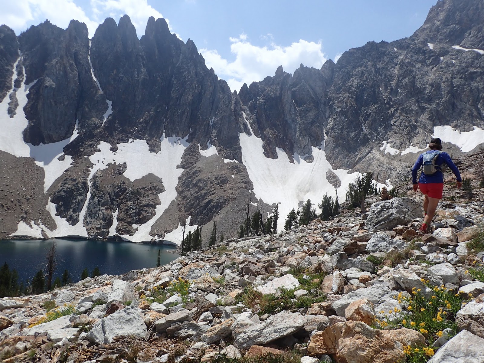
As we got up higher, we needed a cool mountain guide to show us the way:
 |
| so cool |
But actually we didn't even go that way because it looked too burly! But our route was fine:
The flowers were amazing
and even prompted me to break out into song:
Finally we reached the pass that was well over 11k, where a chilly breeze gave me a chance to bust out my secret weapon again:
And downward into our next drainage we went
 |
| this was a mountain goat highway! they must be very social and walk all in a line to catch up on their goat gossip. |
as we descended into the drainage we had to get a bit extreme in the pack part of pack rafting
 |
| Paul making it look.....easy? |
And after a pretty grueling day of descending into the creek bottom only to ascend far out of it to bypass a gorge, we arrived at the confluence of Bruin Creek and Thorofare Creek
 |
| the confluence is up against the trees |
Now that we were in Zin's hood, she became the map master:
There was just barely enough water to float a boat
and sometimes -as it braided - not even that much
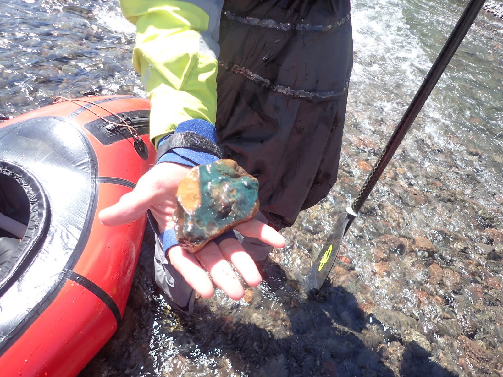
but the slow pace enabled us to appreciate even the rocks on the bottom
Thoroughfare Creek is a tributary of the upper Yellowstone (which, at 692 miles, is the longest free flowing river in the US outside of AK), and on the banks of the Yellowstone is the Hawk's Rest ranger cabin, which supposedly the mostest remotest place in the lower 48, which is a function of farthest from a road. But that didn't stop the FS from making a nice cabin near a nice bridge over the Yellowstone
 |
| A very nice porch. And Drew - as a Teton ranger with a cabin in Lupine Meadows - knows nice porches! |
A long, somewhat tedious day hiking out of the very shallow Yellowstone drainage, albeit with nice views towards the Buffalo Fork:
was punctuated by this spot:
 |
| this little creek splits, with one fork heading for the Atlantic and one for the Pacific. Tho it's probably more likely that the waters are going to Montana wheat and Idaho spuds, but whatever. |
We got down to a meandering meadow that maybe had enough water to float, but again it ended in a steep gorge so we walked it and found a great camp there. I finally got to see some Wild Life
And we returned to floatable water to start paddling again
As we were rigging a few pack rafters came through the meadow, and being the small community it is, we had some connections with them
And on down the Buffalo Fork we went. Paul and I had done the BF a couple of years ago with the New England Pack Rafting Team, but since then a big landslide had come down and created what was probably the stoutest rapid on the trip:
And the rain at the takeout gave me a chance to bust out my secret weapon
I am cooking up a blawg post about this, but my experiment in clothing options made me start to think that the $13, 6 oz tyvek suit blows the Gore stuff away on several different levels. That said, one needs to be able to withstand the huge guffaws from fellow adventurers:
 |
| huh? what's wrong with my suit?!!? |
Thanks again to Forrest McCarthy for coming up with a great loop and a great name and for providing plenty of just-enough beta, and most importantly thanks to brother Paul, Zin, and Drew for being solid pards on a pretty challenging trip to a pretty remote zone.