I think it started out as a trip that had something to do with being in our 50th year. I don't necessarily consider myself to be a big mid-life crisis guy who needs to....prove myself (???) or do something that makes me feel relevant, but then again, if a good buddy wants to go big and another buddy comes up with a great idea to do so, and it happens to correspond with turning 50...well, that's fine; I'm in! And when I got a packraft last year and told Greg and Mike about it and the possibilities that the ability to carry a 8-10 pound kayak that fits into a backpack but still runs decent whitewater represents, about 4.5 minutes of using The Google and we discovered Packrafting the Arrigetch; a trip that legendary Alaskan adventurer Roman Dial did a few years ago. Big mountains, fun creeking, several multi-day trips out of a base camp....sounded great. And since we were baby Alaskan adventurers, we had no problem with doing a trip that had plenty of beta. And we figured that -like all baby adventurers -even with plenty of beta we'd still get plenty of excitement, and indeed we did.
 |
| Roman's map of his backcountry AK adventures. Believe you me, ours does not have very many red squiggly lines! |
Our destination was the Gates of the Arctic National Park, which encompasses a good bit of the south side of the Brooks Range, the major range that goes east-west across the top of Alaska. The park is big: it's 8.5 million acres/13,000 square miles, which - according to the Wikipedia - is slightly larger than Belgium. Within the Brooks range are the Endicott mountains, and within those -tucked into a tiny pocket - are the Arrigetch peaks. "Arrigetch" is apparently native for "5 fingers of an outstretched hand, but I think that really it's like that Indian goddess with many arms; there are lots of "fingers" in those peaks! The Arrigetch is mostly known as an adventurous climbing area; it was first explored in the 60's and now it sees a few parties a year that haul gear and weeks'-worth of food up into the basins to tackle innumerable 1000-2500 foot walls. But it's got passes between the peaks and the creeks that the mountains feed into have plenty of gradient and plenty of water, so it makes for great packrafting as well.
Our adventure began in Fairbanks, where they have a good visitors center that is pretty informative for a bunch of fresh-faced lower-48 joeys looking for excitement:
and we hopped into our rental rig to head up the infamous Dalton Highway. It is "infamous" because we were told that a cracked windshield is pretty much a given, as our flat tires, those donut spare tires are virtually worthless, and grizzlies stop travelers and demand a toll, etc. We figured that the rep was a bit overblown, but it did come into play when we realized that it is difficult to rent a vehicle to drive up it. But with a bit of sleuthing and plenty of money we found the standard Dalton Highway Rig (aside from the semis): the big white pickup.
Of course, it wasn't nearly as bad as we anticipated, until.....it was:
but in the great spirit of "backcountry" travelers helping each other out, one of the first truckers to come by stopped to help us out.
we were all set to change the tire, but he gave us a plug that we stuffed into the hole, and then he had an air compressor on his truck (I marveled at that, and he said "well, ya got compressed air on your rig, so it makes sense to have the hose!" To which I said "Oh yeah, that's right!" But Greg totally busted me by saying "you have no idea what he's talking about!" which was absolutely true).
And back we were blasting along on our plugged tire.
We crossed the mighty Yukon:
and of course we had to stop and ogle a little at this:
I realized that I didn't really even know what the Arctic Circle was. I was sort of expecting a big white line going across the road, up and over the pipeline, over the black spruce trees, and of into the distance, with spruce trees and beavers on one side and icebergs and polar bears on the other. But what we learned from our scintillating stop was that this is the latitude where the sun officially never sets at the summer solstice and never rises at the winter solstice. And over the course of the trip we very much got that sense - that I'm sure is not even noticed by AK-ers -that the sun literally was circling us daily; no rise in the east and set in the west up there.
Our destination was Coldfoot, which looks like The Big Town on the map between Fairbanks and Prudhoe bay, but the truth is that it's a truck stop, an airstrip, and another Park Service visitor's center! (where they kindly loaned us a bunch of bear barrels; they figured the cost of taking out garbage bags of partially-digested people parts is more expensive than free loans of bear barrels!)
We met up with the inimitable Dirk, who owns Coyote Air with his wife, whom we gathered are legends in the Alaskan bush pilot/adventuring communities.
And as we flew, we got a sense of how isolated we were going to be: we flew for over an hour at a pretty good clip, going from the middle of nowhere to the fringes of that middle.
He plopped us perfectly down on a bouncy gravel bar, we took 3 minutes to unload our gear, and he fired up and blasted off:
And I must say, I had a bit of an unusual sense of excitement and nervousness to watch him fly off, to return in 2 weeks. It drove home the point that we weren't in the comfy little convenient Wasatch any more!
The first order of business was to set up base camp. We had a cool little electrified bear fence, but figured with our skull talisman and spraying sharpshooter we'd be safe:
 |
| If you were a 1200 pound grizz would you mess with this guy? answer: absolutely! |
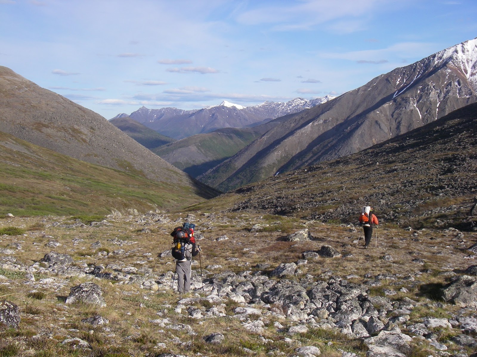
We did a little day outing on a nearby easy creek, then decided to head up into the goods. We didn't actually know it, but there is a trail up Arrigetch creek, but - as we said many times, "Alaska doesn't give it up easy!" and the trail was not much more than a game trail. Not only did our little BD trekking poles come in handy, I snapped one as I tumbled over trying to navigate the "trail".
 |
| It looks like Phil is trying to avoid the water, but at this point our feet had been soaked for hours |
 |
| Nice view of Arrigetch Creek. |
 |
| the only flat spot for miles, with some glimpses through the clouds of the Arrigetch peaks. |
 |
| A shoe dry fest...... |
 |
| that got a little carried away at times. |
Our original goal was to go way up into the peaks and summit one that was a 3rd class climb, descend the backside, and drop deeply into a creek that would take us out to the main river and back to our camp. However, the rain that had gotten pretty consistent started getting pretty thick:
and we realized that was going to be unrealistic. Dirk the pilot had told us that the key to successful adventures in Alaska was flexibility, and this was the first of many times that we would bend to the opportunities and limitations that were presented to us. It was a little discouraging that time, because we had done a pretty dang steep and long hike:
But so it goes.
 |
| Reconciling flexibility |
The plan B was a good one, however; just paddle back down the Arrigetch Creek! so after another night in the rain at a nice camp
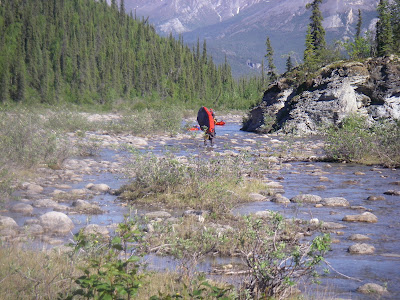
we blew up the boats and got ready to blast down the river. We were not sure where our prior fellow adventurers had put in, so we just went to where it seemed like there was enough water:
and it worked out well:
Until it didn't:
It was a bit bony, so we did a combination of running and portaging for a bit, then portaged for quite a ways until we were able to get back on the water. And even then, it wasn't all runnable whitewater:
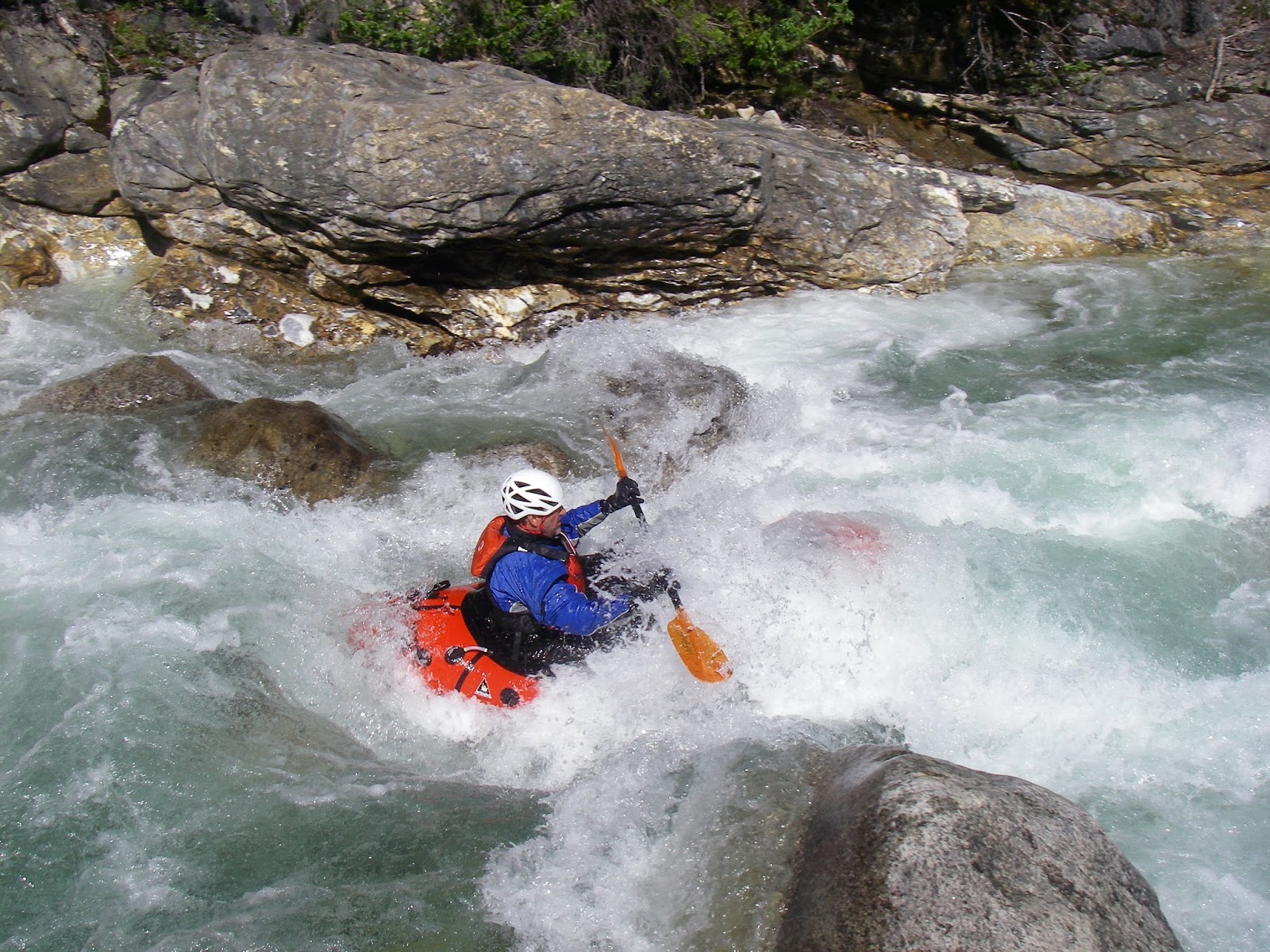
The creek averages 250 feet/mile for 5 miles, and that's a very respectable gradient. We ran a lot of it, but it was a long day, and with the rain the creek was starting to pump up a lot; water was literally pouring down the hillsides into the creek, and the bone of up higher in the drainage was a distant memory as we started to blast holes and desperately claw for eddies. We weren't able to get many pics due to the wetness, but it was fairly solid and continuous class 4, with lots of blind corners and "real" drops. At one point Greg asked me "Have you run shit this hard in your packraft before?" which seemed pretty funny to us both, because I hadn't run
anything that hard in
any craft for a long time!
We kept pressing on down the creek trying to "turn it down a notch" due to fatigue and fear, but the river kept up a pretty ferocious tempo. Finally at one point I got out to scout and saw a pretty solid long, white, fast, relatively eddy-less section of class 4 - 4+ that blasted around yet another blind corner, and the only line I saw...... was the potential alder thicket thrash to escape the gorge we had been in for hours. I suggested we pull the plug and there was no argument: we'd been on the river for 12 hours, and due to our leisurely start it was....midnight. So we deflated the boats and marched back to camp, arriving just in time for our 3am dinner. So it goes where the sun never sets.
to be continued....