Friday, September 4, 2015

A bike tour of Yellowstone

I did my first bike tour when I was 14 (in the San Juan Islands) and even though it poured rain I was a geeky enough kid that I loved it and wanted more. It took me getting too cool for bike touring in high school and then coming back around to it in college to get going again, but since then I've found it to be the best way to travel, both here in the West and in other countries and cultures, and I was fortunate that Ash has always had a comparable passion for it and we've had loads of good two-wheeled adventures.

Brother Paul did his first bike tour in about nineteen hundred and eighty with a buddy in the Napa and Sonoma Valley area, and if my math is correct  -and it may not be  -he was too young to partake in the winery bit that makes bike touring there appealing to folks who like that kind of stuff, and they weren't very thoughtful in their route choices and ended up on big, busy roads doing long hot days with few camping options.  For lo these many years hence I have partooken in many a great tour and henceforth waxed poetic of their joys, but he hath resisted the call.  It finally took Paul tearing his ACL this spring and a recovery that essentially limited him to riding his bike this summer - with no on-foot adventures - that led him to say "I'd like to do a bike tour."  And Yellowstone seemed like an obvious choice.

Our national parks are such anachronisms:  the visionaries who created the parks truly got some of the most remarkable natural features and scenery on the planet, and made them very accessible to literally anyone with a pulse, but with that grandeur and accessibility comes....people. Loads, hordes, teeming masses of people.  And apparently 2015 was a record year for our national parks; Utah's "Big 5" campaign resulted in generally un-manageable crowds.  And we found out that Yellowstone also had its biggest visitor year ever, which is saying a lot for the oldest and one of the most famous national parks in the world.  But despite being generally assured that there would be crowds and therefore traffic, a tour that Ash and I did a few years ago made us realize that it's never that bad, because speed limits are low (max of 45mph) and since people are on vacation they are in a mellower state of mind than blasting around town in order to get back home to relax with their g & t (a question we pondered:  is it the same people who are mellower on vacation, or do mellower people go on vacation?).  The biggest worry with drivers is that they tend to lose all sense of rationality when wildlife sightings are part of the game.

Yellowstone is a great place to tour on a bike for a few reasons:
  • it's a bit too big to do big day loop rides, but tight enough that no distances are ever too far, even though the scenery isn't jaw-dropping beautiful like Yosemite or Zion
  • there are lots of smaller, more-intimate, and really interesting things to see so it's easy to pedal from one site/sight to another
  • in a car you'd probably just blow right by most of those interesting things
  • the campgrounds are not only situated good riding-distance apart, but they all have specific campsites that are always reserved for cyclists, and they are $7.98 a night.  
There are also lots of places to "poach" camping, but there's really no need to do that; we didn't bring ropes to hang our food, and it's easy to beg for late-day cold beers from our fellow campers!  
All ya gotta do is ask.....
Our plan was pretty simple:  They have a route they simply call The Grand Loop that takes in all the highlights of the various geyser areas, the famous hot springs of Mammoth, the falls and Grand Canyon of the Yellowstone river, the various geyser areas, of course Old Faithful and it's remarkable lodge, all in a very approachable couple-hundred miles.  

We also wanted to head up the Lamar Valley since the NE corner of the park is where some of the ruggedest terrain is easily accessible. 

West Yellowstone is the most efficient place to start  tour (and it has a great taco bus):


with a nice spin up the Madison river valley to access the Grand Loop.  We chose to go clockwise, hitting the Norris area first.  Sure enough, the Norris campground was full, but the prime spot reserved for cyclists was waiting for us.  Next up was Mammoth; a mandatory stop on the Tourist Trail, and it's worthy.  


Of course, for my upcoming coffee table book: "Tourists of the World" there was plenty of fodder there:


dork tourist in training
And this poor tree suffered the brunt a while ago of a shift in the flow of hot water:

We headed east on a nice rolling road towards the Lamar Valley.  On our trip a few years ago Ash wanted to camp in the Lamar Valley "to see the wolves", but I scoffed at that remote possibility that we'd actually see wolves advocated camping at Tower, which is just above the valley.  The next morning at the entrance to Ash's desired campground we saw Fred from Georgia who was telling one of his buddies:  "I looked out and saw me some antelope, so I hollered to Myrna to come look at the antelope, and just as she came out a coupla wolves came in and took it down!"  Huh?  You saw a coupla wolves "take down" an antelope?!?!  I was aghast at having missed that, and Ash has never forgiven me, so of course when Paul and I returned the first thing she asked was "did you see wolves in the Lamar?"  This time, again, we did not, but it was still great riding  


But if you are into bison (and wolves probably are) the Lamar is the place to be; there were herds of hundreds.  And despite warnings like this:


People still bumbled around the bison:
Though to be fair, it was actually a little scary to ride near them because they got spooked not by cars but by bikes!  They'd freak when we went by.

We rolled into the Pebble Creek campground near the NE entrance to the park and of course it was....
the next morning it was filled for the night by 9am.
but of course the bike site was open! And not only did we again score some nice cold beers from fellow campers, the camp hosts also had a scrabble game! 
it was the most unusual request they've had in 10 years of camp-hosting
The valley in that area is dominated by the imposing 3000 foot wall of The Thunderer, and with a trail going up to a pass accessing what seemed to be a viable east ridge, and a bearing a moniker like "The Thunderer" I had to give it a go.  

First thing in the morning I pedaled a mile up from the campsite to the trailhead, stashed the bike, and trotted down to the creek crossing.  I was surprised to see not only a cloth "dam" across the river but also the water was running blood red!  There was a woman with chest waders on in the creek clearly doing some work, and she only spoke Spanish, so I only half-understood that there was some toxins in the water for an invasive fish kill deal.  I was about to wade across, but the word "toxin" and the chilly air temp and the presence of a big lodgepole that had fallen across the creek just upstream sent me up there to keep my feeties dry.  I got halfway across the log and realized how springy lodgepoles are; it started oscillating with my steps and with my attempts to get stable it started oscillating more and more, and.....of course it bucked me off in an inglorious belly flop into the chemical creek.  So I was now fully soaked and it was 39 degrees, but at least I had some sort of toxin on my skin that would undoubtedly make my skin flay off!  Whatever; I charged on up the trail knowing that I'd soon warm up with a 3500 foot climb. 

Running alone in Yellowstone with a population of nearly 1000 grizzly bears is generally against typical tourist protocol, but I kept hooting at them and of course had my trusty bear spray ("when the bear charges, aim accurately, adjust for wind, and spray the bear directly in the face"  - oh, it's that easy?). The trail passed over the ridgeline, where I left it and marched up the ridge that had some scrabbly third and fourth class sections, but ultimately got turned back at 5th class section a couple hundred feet below the summit.  I checked The Google on the Interwebs later and saw that someone had posted that "the Absorka (mountain range) rhyolite is so terrible that it's likely NO ONE has ever attempted to summit The Thunderer!"  Hmm.  Something tells me that someone has done it.....

The climb out of the Lamar Valley to Dunraven Pass is pretty long, and Paul and I trudged up it:

We started up the gravel road that leads to 10,000 foot Mount Washburn, but bailed soon thereafter due to gathering dark clouds, thunder, lightning, and rain moving our way.  At the pass we hunkered out of the rain in the doorway of the shitter:
I should do a post  - or maybe just a photo album  - of how many times shitter doorways we have utilized over time.
We rolled into the very commercial Canyon campground (run by "Xanterra", the company that has the license to many national park concessions; that name sorta gives me the creeps, and I liked their old one:  "Fred Harvey" much better...) and immediately met the Avid Austrians Rainer and Veronika: 

who had ridden to Yellowstone from.....Fairbanks!  They had some tales to tell (and will be in Salt Lake this weekend, provided they don't get blown back up to Yellowstone by the ferocious south winds).  

While the Canyon area is sort of overly-developed, it's popular for a reason: the views of the upper and lower falls and the Grand Canyon are sublime:


I would love to paddle this section.  Inexplicably, although pretty much anything goes in almost all national parks....except whitewater kayaking in Yellowstone!  don't get me started....
Rambling south, then west, then back north towards Old Faithful is a good combo of flat
 and hilly riding, with a long descent into the vast excitement of the Old Faithful/Geyser Basin area.  The Crowd eagerly awaiting Old Faithful's eruption:

And the dorks who missed it because they were looking the wrong way:

the hot pots and such are pretty cool:


some provided a nice steam bath:

and there are even some nice bike-specific routes in the area:


We did a 2 mile hike to a trickly little waterfall, and met a woman who would make Steve Madden proud with her choice of footwear:
yes, she got blisters.....
And of course there were some classics to go into the coffee table book:
Expensive camera to shoot pictures of very mundane creek in midday sun?  Check.  Michigan shoulder strap bag?  Check.  Bear spray to protect self when walking on a couple of hundred yards of railed wooden walkways?  Check!
Manpris?  Check!  
guided trekkers ready to go on a flat 1mi hike with their guides, 10 essentials, and trekking poles
Though I suppose it's easier to be getting accustomed to, it's remarkable how many seriously overweight folks there are out there, and disturbingly, so many kids.  Maybe national parks attract sedentary folks  -and to this guy's credit he was out hiking - but it's easy to see the obesity problem in the US whence in the national parks.  
And a coupla dorks who think they are far cooler than they actually are. 
With another thunderstorm wind blast shoving us along we flew back down into the Madison Valley
Though I had to be a little careful by not pedaling too erratically; I've broken a lot of things, but the first time I've broken a clipless pedal.  
for one more night at a full campground in the bike zone before spinning back to West Jellystone the next morning.

Stats:
Miles:  a fair number, but not too many.
Vertical:  as much as we could, given the roads we were on.
Time: passed
Calories: lots
Fun:  pegged the meter!

I think brother Paul is now the latest bike touring enthusiast.....


Monday, August 17, 2015

Bridger Ridge Run

My journey to the Bridger Ridge Run began two years ago, when my great running buddy Derek Gustafson decided to finally put his natural trail running prowess to a competitive test by entering what I think was his first trail race in his hometown of Bozeman.  He came back to SLC raving about how great the course was and that I had to go join him there sometime.  A year later Derek went back again and improved his time by nearly 15 minutes and was a close 2nd place, and again reminded me how awesome it was and that I HAD to go do it.    Ok, I'll give it some thought.

Around the time of Derek's 2nd effort he also asked me if I wouldn't mind introducing him to my friends at Oboz, an up and coming outdoor shoe company based "outside Bozeman" (ergo "Oboz"; very clever).  My heart sank, because I knew that if the folks at Oboz had half a brain they'd hire him, and they certainly have well more than half a brain!  So of course they hired him, and off Derek went.  But Bozeman is a nice place to visit and relative to the upcoming Wasatch 100   -which I inexplicably entered last winter, and then actually got into  - the timing was good, so I thought well, if there is any year that would be good to give the Bridger Ridge Run a go, this was the one.

Apparently the Bridger Ridge Run is one of the older established trail races in the US, celebrating its 30th anniversary last year. It was initiated by a character named Ed Anacker, who after riding his bike from Minnesota to Montana during the Depression kept his athletic prowess going  - doing a lot of pretty ridiculous exploits - until he ran a very early rendition of California's Western States 100 and thought that Montana should have a comparable race.  Hence begat the BRR (Here is a more complete history, if you are so inclined).  Ed died a few years ago, but his legacy has been carried on by a race director who's clearly as colorful as his predecessor.

As with many silly endurance races, the BRR's popularity outstrips its capacity, so they need a process to cull the entrants. Most races simply use a lottery, but of course the quirkiness of the BRR enables it to do things its own way, and in order to actually get into the lottery you have to write a 50 word essay with the reason that you should be deemed worthy to partake in their esteemed event.  Derek - having gotten 2nd in 2014 - wrote in his essay that his only goal was to improve his finish by one place.  Given that saying anything in fifty words or less is pretty hard for me, I had to keep it tight:  "My good running buddy abandoned me here in desolate SLC and as retribution I need to come up to your silly race and kick his ass!".  Ash was also intrigued by a fun weekend and a rugged outing, and her essay was something to the effect of "My psychotic husband has told me about your silly race and keeps mumbling about retribution or some such and we only have one car so I guess I have to come up with him!"  For better or worse, all three of us got in.

One problem that I faced was that I had a sore knee all winter and as spring sprang and I started running more it did not improve (what a surprise), so I went through the various phases of injuries (ouch, many months of ignoring, very sporadic and ineffective icing and ibuprofing, very limited stretching, some massage, a fair bit of physical therapy, and finally subsequent visits to a general practicioner doc, a sports specialty doc, and finally an orthopedic doc) until I realized I had a torn meniscus (cartilage around the knee).  I made a futile request to get the surgery scheduled between my trips to AK and Peru, but the doc pointed out that taking long distance flights - which are known to create blood clots by themselves  - and spending two weeks with open wounds on a river downstream of several towns in a developing country wasn't that wise, so I ended up having the surgery post-Peru and three weeks prior to the BRR, with basically almost no running all year prior to that.  But at least the BRR features a punishing 9000 feet of descending!  A good test of the surgeon's prowess and the beauty of not-very-invasive surgery.

The week before the race I asked Derek what shoes would be best for this course.  He sent me this pic:
And said "This is the terrain for about 40% of the course!"  Yikes.  I realized that I needed to very much get my goat on for this outing.

On the way up we stopped in Pocatello to loosen up the legs on Poky's great trails -that warrant much more exploration  -with our friend Jake (who just moved there from NH), and arrived in Bozeman a few minutes late at the last of the three pre-race meetings just in time to hear the aforementioned character of a race director say "For the first time in 30 years, there are NO course markings!", which of course would come back to haunt him the next day!    To add another element of intrigue to the race, it's a point to point, and they don't supply a shuttle; the race director asked how many people were driving up to the start and about 3 folks raised their hands, to which he said, "well, I guess there will be a few very full cars" and left it at that!

The race starts with the longest climb of the day, from about 7700' to about 9700 feet in a coupla miles, and from that high point you can see most of the route, which is a bit astounding:  20 miles of a rugged and rolling ridge looks like a LONG ways!  But for better or worse, the smoke from wildfires near and far made the ridge just sort of disappear into the distance, so I just put my head down and started plugging along.  That is, until a nearly got hit by a football-sized boulder that got rolled down past me by a herd of (actual!) mountain goats meandering around the trail.

Things went along well until a guy Derek had introduced me to at the start line suddenly appeared running towards me and said just two words: "wrong way".  Ironically, at the first aid station the kind, well-meaning, and under-informed volunteers had put up a ribbon blocking the ridge trail and sent us down another trail that led essentially into never-never land.  Derek had moved ahead of me on the first climb, and I knew that the savvy veteran would not have taken that wrong turn....but soon enough there Derek was following me back up to the ridge trail!  The guy who was leading the race at that point took a bit longer to figure out the err of his ways and added something like 7 extra miles - and a cougar sighting - to his longer day.

The route is indeed worthy of  - apparently  -Trail Running magazine's "bucket list" of races to do.  The trail is quite rugged with plenty of dancing along adjacent to multi-thousand foot plunges off the ridge (that would make for great skiing!), and the rock is sharp limestone that loves to trip grab shoes and slice and bang up those folks unfortunate enough to not recover (one broken leg and one broken collarbone), but much of it is surprisingly runnable.  I chugged along right around 10th place feeling pretty good but kept in mind Derek's words to "keep something in the tank" for the final descent: 4100 feet down to the valley floor.

The last aid station was at the top of Baldy Peak, and I had just finally passed the 9th place guy who had been slowly coming back to me.  He left the aid station a few seconds before me and I charged out after him and went literally a couple of hundred yards down the steepass descent before my left inner thigh exploded in a crippling cramp.  I had just hammered down a couple of salt tablets and a fair bit of electrolyte drink, so I felt like I was watching a cartoon of myself waiting for the pepto-bismol-looking stuff to flow down my gullet and eventually into my groin.  And suddenly....it did!  The cramp eased as suddenly as it had emerged, and I blasted off again.

As I realized later, the final descent is legendary among the many BRR veterans:  it's long ever-steepening, but at least it's rocky, loose, and technical. I tried to channel my inner Derek, who's as much of a Prancer as any trail runner ever, but I could still only muster about 10 minute pace downhill, as hard descending needs as much or more training as climbing, and my short summer of training hadn't really allowed enough of that.  But I finally limped into the finish in 12th at 4 hours flat:

Derek had taken the 40 plus honors ten minutes ahead of me, and 20 minutes down from the winner.

And Ash - taking advantage of her climbing strength and the technical descending  - had a strong outing as well despite equally-limited "training":

A competitive field and a fun day in new terrain. If one is so inclined, here are a couple of videos that are going to apparently be made into a longer movie:  here's one and here is another.  

That said, I heard about friends this weekend who a) tried to run across the Sierras, b) ran up Gannet peak (highest in Wyoming), and c) did a big loop in the Wind River range, and were able to chit chat, save some money by not entering a race, probably saw virtually no one, and probably aren't as crippled as I am now by trying to give 'er too hard because I was racing.  Ah well, lots of ways to get one's ya yas in the mountains.

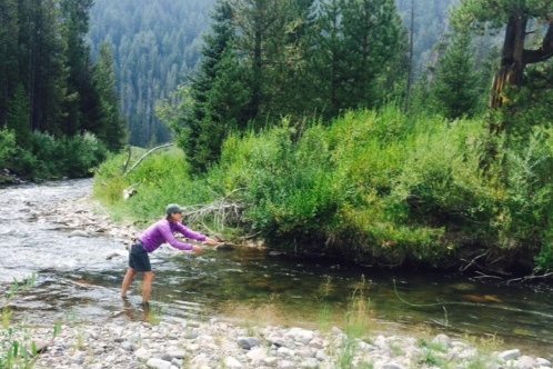
Our weekend finished up by having Wasatch Community Garden's recently-departed Bill not only set up our new Tenkara fishing rods for us (he first had to gently tell us that we needed to take the plastic off our rod handles!) but also take us out to his secret haunts and impart to us the ways of the water. When you are in that area in the summer it's pretty clear that fishing is The Thing, so we might as well give it a go with a willing and patient instructor.  We were absolute gumbies, but we did actually catch some fish, and it gave us the opportunity to soak our sore legs in the water!
Ash layin' it down....
I think she's....hooked....
And thanks again to our great friend Audrey (a 2nd Wooding sighting in a month!), who put up with our shenanigans for the weekend:


Sunday, August 2, 2015

Rio Maranon - final post

When you go on any trip to a great place, it's easy to take pictures of all the gnarly stuff and try to capture the most beautiful views you can to (usually unsuccessfully) try to convey how amazing it is on "film".  But the truth is that biggest component of any great trip is the crew.  When Kiwi Andy said he wanted to put together a crew to do this trip and Rocky was going to spearhead the organization, I knew that would end up being a stellar crew.  And I was not disappointed.  So below is a quick series of snapshots of the crew:
Bruce the Kiwi Pharmacist yapping it up with the local kids
David the smooth rafter from Colorado - who pulled off the trip with a week's notice  - sporting the original Patagonia CFS shoes that he loves to love, which of course made my heart sing!
The aforementioned ace archeologist Nico, trying out an old school watercraft
Whitewater ninja masters Pedro y Andrey
Fico, a Peruvian river legend.  

striking a striking pose, Rocky Contos, deep in another gorge; his element.  
a coupla goofballs testing the dubious integrity of a skitchy old ruin
Ruggedly handsome Mike Brehm safely transporting wood downriver. 
Kiwi Rich enjoying the tropical river's bounty
Tomas, the unflappable Chilean, proud of the gigantic South American avocados
some strange ogre who had a bad run in with some burrs whilst dropping his "trousers" for a foray
in the weeds
Kiwi Andy taking the only shower of his trip
The ever-grinning Ross (with Andrey)
the Paraguayan Paddler Ariel
One thing that some of the great river of the American West have is natural hot springs.  The middle fork of the Salmon has probably "the best", but there are great springs on the main Salmon, the Bruneau, the Owyhee, the Payette, and others.    Not to be outdone, the Rio Maranon has one that rivals it's American brethren:
the perfect 104 degrees, good river access, and you can scout the rapid from here!
the locals clearly prize this gem....
One critical aspect of river trips is side hikes; the Grand Canyon has a zillion, and the trail networks along the Selway, Middle Fork, and Main Salmon are extensive.  The Rio Maranon has its share, tho most are pretty short. here are some samples:
trying to hold it together
a coupla cool gorges

feeling the power of the canyon
Ash exploring a cool gorge


Locals had dammed this a bit to get some irrigation water. 
And then it came time for the end of the rio.  We tore down the boats with help from the locals:
And did the gratuitous end of trip shots:


We ended on a beach adjacent to a village that had one restaurant and a hostal:
I wish I was cool enough to have a "Hostal Tom" named after me
Our diminutive hostess, who was wondering where these giants came from.
Despite the remote nature of this village, there is a real airstrip there:
Note the turn; we. started way back and went roaring around the corner with plenty of G-forces
the open air "terminal" with the ticket agent working on a jungle-wood table
This was the only clock in the place, and it didn't work; good thing someone brought a watch!
After the corner the runway was only 400m long, so the pilot wound the engines up to full throttle with the brake on before releasing the brake (and maybe smoking the tires?), roaring around the corner, blasting off the end of the runway, and then working hard to get out of the canyon.
Ash pretty excited by a pretty exciting flight. 
We ended up in Huanchaco on the coast after a 45 minute flight; the crew who went back with the river gear took 16 hours (on class 5 roads) to make the same distance!  

Huanchaco is a well-known surf mecca, so a few of us (who know how) surfed and a few of us thrashed around in the surf with wetsuits and boards and took a healthy beating.  We realized that there are other easily accessible ruins in Peru that are not Macchu Picchu; near Huanchaco/Trujillo are some amazing ruins


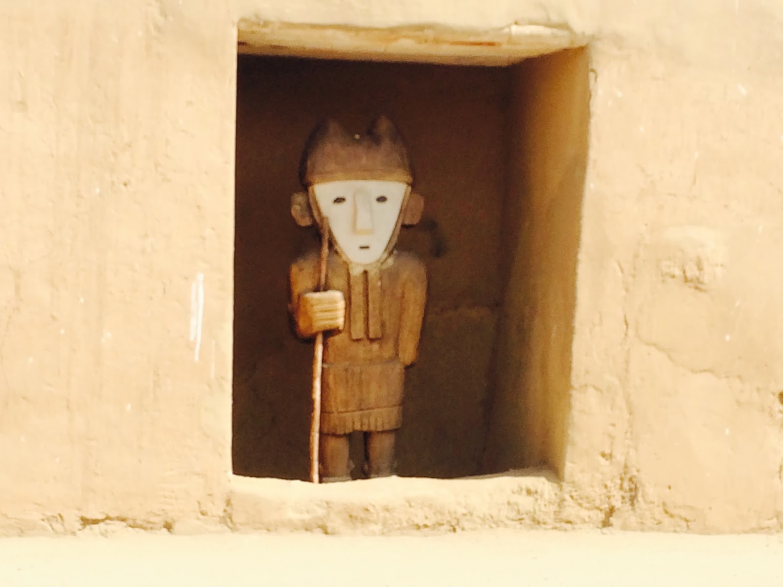
Pre-Incan stuff
Nico once again moves to the fore with his vast knowledge of Old Peru

These hairless dogs are native to Peru, and there are multi-thousand year images of these dogs in the ruins.   It's a law that all antiquity sites have at least one of these dogs as a resident.  She needs a daily dose of sunscreen!    

And joins the tours!

this particular ruin mandates a guide, and this guy was quite a character with a great passion for the place and vast knowledge that he acquired on his own, without any formal schooling. 

This ruin is huge, and was only discovered 20 years ago.

Dork
Having come recently from Alaska myself, I wondered what it was about Alaska that inspired a Peruvian candy bar!

Gringos lost in the desert
And then we headed for home. 

The worst thing about this trip is that this amazing river and canyon is that it's getting dammed.  This past week the Salt Lake City Weekly ran a cover story on the River of No Return:

Which is a romantic-sounding old-time nickname for the Salmon river but it sorta nonsensical today.  But the Rio Maranon may indeed be the true "River of No Return", because only one dam can ruin hundreds of miles of that narrow gorge, and they are planning somewhere between 10 and 20 dams!  So if you have an inkling to do an amazing river that will likely go the way of the Bio Bio start making plans now (I can put you in touch with Rocky/Sierra Rios).  And if enough people go, it has the potential to make the governments rethink the dams in favor of preservation (not only of the river, but of the thousands of people who live along it) and recreation, ala the Futalefu river (in Chile) which may have staved off damming for this reason, and the national park in Pumalin, Chile.  

Thanks again to Rocky and his crew for helping with an amazing adventure and for spreading the word to the world that this gem is not only incredible but also endangered, to the Scotsman and Fico for some of their pics that I liberally poached, and our excellent crew who made the trip a hoot.