Friday, September 15, 2017

Pack Rafting the Grand Canyon of the Elwha


I first heard about the Grand Canyon of the Elwha in about nineteen hundred and ninety two.  At that time I was an enthusiastic kayaker who - along with Mike Elovitz and Michele Martin (Gray) and other pards - was paddling all sorts of class 3 and 4 rivers in northern Oregon and southern Washington and theoretically was aspiring to do harder rivers that were farther afield but never really got the experience or confidence to do them.  And one of the mythical rivers was the Elwha:  deep, dark, difficult, and foreboding, with must-run, difficult-to-scout class 5 rapids and  - gasp - you had to hike every inch that you paddled!  There were so many great rivers to do that had easy access to the put ins and takeouts that the concept of carrying your empty kayak more than a couple hundred yards was never really considered, much less carrying a kayak loaded with gear and food for overnight trips.  One of Michele's friends was a top level paddler at the time and definitely had the temerity and skills to tackle something like the Elwha and dragged his boat the 9 miles in, only to find that he had ground a substantial hole in his boat; self-bailing kayaks don't really work that well.

Lo these many more years hence and I've paddled a fair number of challenging rivers, tho not so many over the last few years, and even though I've done a number of trips to Washington, the Olympic Peninsula was just that much farther than the rest of the state, and the Elwha only really "goes" in the summer after the snowmelt and rain that feeds the other rivers that lured us to the area, so it had pretty much fallen off my radar.

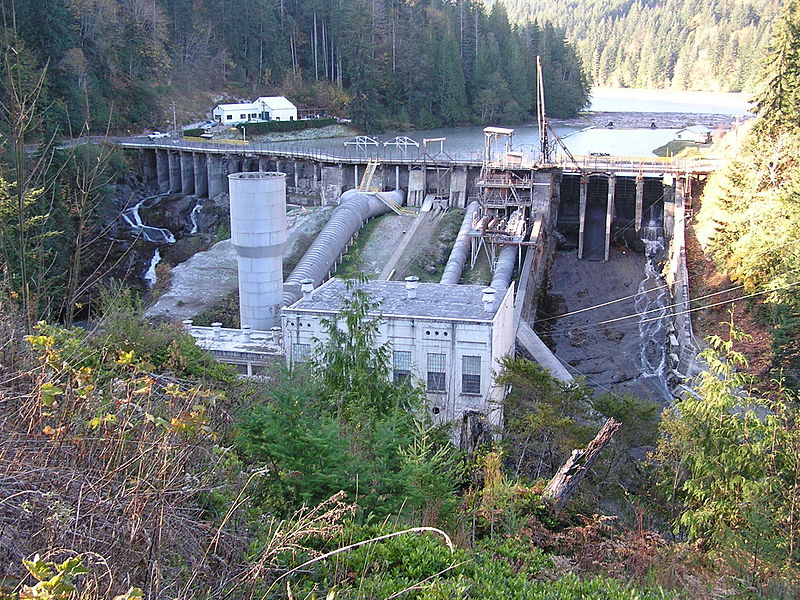
That said, the Elwha did make national news in the late 90's and early 2000's when it became the first American river to be seriously considered for the removal of its ancient dams.   The river flows off the northern side of the Olympic mountains down to the Straight of Juan de Fuca:
the square is where the Olympics are

some detail:

and is only 45 miles long, but its presence in one of the world's great rainforests made it an early target for dam builders, and starting around 1910 an individual built two dams on the lower reaches for hydro power.  This was devastating to the watershed; the Elwha is one of the only rivers in the country that supported all the big salmon species of the Northwest:  Chinook, coho, chum, steelhead, pink, and sockeye, as well as bull and cutthroat trout.  The pre-dam salmon runs were thought to be in the 400,000 fish range; post-dam this number had dropped to a dismal 3000, and the effects on the watershed (salmon predators, the riparian environment that depends on fish poo and carcasses, and the lack of a sediment-deposit delta at the Strait) were considerable.   Washington state actually anticipated such a scenario, and according to an 1890 statute:  "Fish passage devices must be built wherever fish are wont to ascend" but the dam builder ignored this (they pursued him, and he tried to mitigate by building a hatchery, but it was a shit show and never worked).

The dams generated about a third of the power needs for a mill in Port Angeles, but under pressure started by the local native tribe and then pursued by the likes of the Sierra Club, American Rivers, and others throughout the 80's the concept of dam removal became more realistic.  It finally became a hot political topic in the late 90's with Washington's two senators being strongly split on the subject, but ultimately Republican Slade Gordon - who had actively campaigned against removal - relented and the land was conveyed to the Department of Interior which was to organize the removal.  It was at this time that I was reminded of the Elwha, since I was working at Patagonia and Yvon Chouinard - who hates dams more than most folks - got involved in the effort as well.

It took another decade to get the project going, and $300M+ later (the 2nd biggest renewal project the National Park Service has ever undertaken, after the Florida Everglades restoration) both the dams were taken out, which set the stage for a cascade (if you will) of dams to follow:  Marmot on the Sandy in Oregon, Condit on the White Salmon in Washington (the link is a video; the first two mins are really cool), and - this summer, with a huge effort by one of my Arctic pards Brad Meikeljohn - the Eklutna river dam near Anchorage, among others (the Matilija dam, near Yvon's house in Ventura and another worthless piece of shit dam, still stands, despite his efforts there).

All that said, the dams did not affect the dramatic canyons upstream; Lake Mills - formed by the Glines dam - came up to the mouth of the canyon, but not into it, so paddling the stretch has always been an option for the intrepid.  

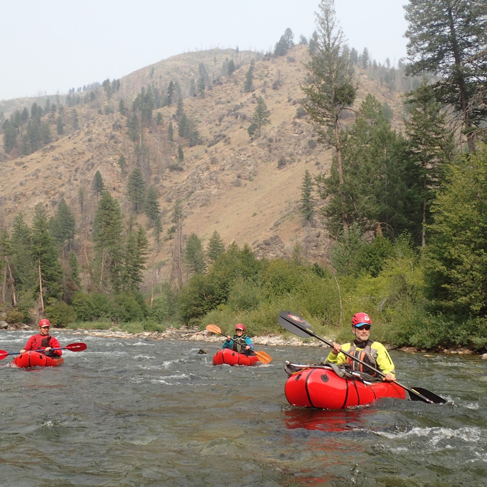
Which led to a couple of weeks ago when Mike Curiak asked me if I was interested in the GC of the Elwha, and instantly it came back on the radar.  The new generation of pack rafts are absolutely viable for class 4+ whitewater, and combined with the packability of them makes them the perfect craft for and adventure like this, and I felt a little sheepish that I hadn't thought of it myself!  The online videos that we found made the canyon sections indeed look pretty intimidating, but we were planning on being in there with about half the flow that we saw in those videos, which we hoped would enable potentially-less commitment to the unportageable/unscoutable gnar.  And Mike - being at the nexus of many strong adventurers, also had another good pard in Thor Tingey, one of the owners of Alpacka pack rafts, so we had a good threesome.  After a surprisingly-little amount of emailed organizing conversations, we were headed for Washington, with our incredibly-compact crafts in our checked baggage.

Our first adventure started at the trailhead, when in the gratuitious gear clustering Mike gave one of those sort of desperate "ooohhh" sounds that makes your heart sink, 'cause it's bad.  No spray skirt. But another great benefit of having Thor along is that not only does he have a good solution to the problem, he is probably the only guy willing to do it:  cut holes in the bottom of his boat!  Though kayaks can't be self-bailers, rafts can, and one of the models that Alpacka sells is indeed a self-bailer, so Thor just cut holes in his floor and gave his skirt to Mike.
Mike anxiously watching Thor cut holes in (Thor's) boat.  
And with that we were marching happily up the trail!

I grew up in Oregon and "know" rain forests, but it still always amazes me at how green it is up there, how big the trees get, especially on the Olympic Peninsula.
It's kinda hard to be a Tree Hugger when the trees are this big!
a crazily-barked tree
Mike tried to count the rings but got tired....
something tells me that even if no one was arounds, this one made a big noise when it went down....

You don't see funghi like this in Utah....
And after a few hours of hiking (on the trail high above the river) we were at the river's edge, which made for a nice camp.
Looks pretty mellow; how hard can it be downstream? 

Shortly below this the walls rose up abruptly and - as nearly is always the case when that happens - the rapids began. The first rapid of note is Eskimo Pie, likely named for its mostly-white (water) filling that's punctuated by black ledges.  Scouting only happens from above, and if you don't want to run it....well, you probably shouldn't have gone there in the first place.  That said, the water was low enough that we were able to delicately portage the first ledge hole, which had a ferocious boil coming up from the tumult of the ledge drop, and the move was to slide off the rock and  - again, delicately - slide across the top of the boil with the intent to come off of it going downstream and not get sucked into the hole you just portaged.

Fortunately the remainder of the ledge holes downstream were not as sticky and we were able to bob down them with only a couple of boof strokes to sail over the holes.
all of the good pics here are Mike's; mine are the blurry/poorly composed ones!  
clearly my photo, but barely worth including to prove that indeed Alpackas boof!
The next obstacle was the one we were most worried about:  any rapid called "Nightmare" probably isn't one that river runners will be keen for.  Again, only really scoutable from the top and a mandatory run due to the vertical walls, but Nightmare has the added bonus of a bit of a web of big logs at the bottom.  Helmet cam video we'd seen on the interwebs at high water made it look like you had to try to literally crash through a hole between logs and was unnerving at best.  But from our vantage point above it appeared that at our lower water level the rapid ended just above the logs and not only was there only just current there but also possibly an eddy, and again the top of the rapid was the gnarliest bit that was portageable so we could slide into the heart of the rapid with confidence that we wouldn't be heading into the log fence out of control.  And thus it came to pass:
Thor boldly charging towards the fence

getting closer.....
Mike's POV as he's blasting towards the fence. 
indeed there was much rejoicing at having cleared what we thought would be the most challenging part of the journey.

After paddling another half day of great class 4ish rapids in the beautiful gorge the walls suddenly fell away and we were in the canyon between the canyons where it was open, inviting, and campable.
The next morning we paddled another short distance downstream and again the walls rose up abruptly and we entered another deep and darkly-greened gorge.

 "Goblin's Gate" was the first rapid, which - yet again - had the gnar up top, but this time the scout came with a price tag; the "eddy" to get out was basically a packraft-sized bit of still-pretty-swiftly-moving water right at the horizon.  With the information from Mike (who had waded downstream a bit, which itself was not an insignificant move) Thor was able to drive into another mid-river micro eddy and then drive across the current and - taking advantage of his skirt-less boat - leap out of it and onto the rocks.  A solid, bold, and necessary move, done at the lip of the drop that we indeed did portage.  But the rest of the rapid went just fine, as did the good number of class 3-4 rapids downstream that were exciting enough to keep us on our toes but let us look up and marvel at the gorge that indeed Goblins most certainly love.
Mike getting a faceful

and keeping those paddle strokes in tight!

Based on the height of the logs above the river, there has clearly been some real water flowing through here.... 

Only in the northwest are the slugs keen to pack raft....

And soon enough we popped out of the canyon.

I felt pretty giddy; not only had we successfully gotten through a challenging section of river that I'd heard about for about 25 years, but we were bobbing merrily down a river:
that used to be a lake.
It's not a section that is "worth" paddling on its own, but the presence of moving water and the clear ability of the river and the riparian environment to have repaired itself so much in such a short time made me pleased that the federal government can indeed do good deeds and also validated the financial support that I've made for lo these many years to environmental activist groups.
silt buildup behind the old dam. 
Approaching the old dam
Unfortunately, the section below the upper dam is apparently filled with riprap from the broken dam itself that has been taken downriver during floods and thus is dangerous to paddle; the irony of this was not lost on us (the class 2-3 canyon used to be rafted commercially).  A cost for sure, but the various salmon species are no doubt charging up past the debris with nary a slight deviation from their spawning missions.

Thanks again to Thor for the idea, Mike for spearheading the trip (and letting me poach his great pics), inviting me along, and both for being great pards on a challenging excursion.
our favorite shot from the trip: clear water, great rapids, and beautiful rock in a stunning gorge


Monday, August 14, 2017

A Return to the River of Return

Four years ago Tom Macfarlane invited me on my first ever pack raft trip:  The River of Return.  I was sort of a pack raft gumby at the time; I borrowed an old-school tubby boat that required a bow-mounted pack, had an awful leaky skirt, and for a pack I used a river bag with shoulder straps as a pack, which was woefully uncomfortable since it was designed to haul up a beach, not 45 tough miles, but at least the rubber bag turned my back into a sweat-fest.  But the journey itself was amazing, and when the New Hampshire Pack Rafting Team wanted to do it and brother Paul was keen as well I was quite happy to make my Return.


The River of Return is so named because it starts on the Salmon River, which has the oddly-romantic, but still-inexplicable nickname of the River of No Return, but when the venerable Forrest McCarthy pored over maps and realized that a great weeklong loop can be made using the Main Salmon, Big Creek, and the Middle Fork of the Salmon back to your start point, well, there was only one natural name for this trip.

Our trip started in the spring, when we decided that we wanted to do this trip but we hadn't had the foresight to apply for a Main Salmon permit during the signup window in January.  Historically it's been pretty easy to get cancelled permits once the season gets going, but the Forest Service changed their system so that when a permit was cancelled the first person to nab it online was the taker.  However, some way-uncool person figured out how to create an online "bot" that was constantly monitoring the site and would instantly grab any cancellation that came up, and apparently this person was attempting to sell a subscription to this "service" to his fellow river runners.  The Forest Service got wind of this and changed their system, and I heard that the 'bot creator is still recirculating in some awful ledge hole on his way to Hell.  However, the new system was suspect as well; they would post a cancellation one day and the permit would come open on a first come, first serve basis at exactly 9am the next day.  Our small crew then began to rally to go for these permits, and with an atomic clock at the ready the instant 9:00:00 turned over we "applied".....and they were gone.  I was convinced that it was again being 'botted (is that a word?) or the system was otherwise somehow rigged, and we should just poach it, but about the time Paul pointed out that sounded a lot like our petulant President he sent out a text at 9:01 saying "Got one!"  I love the new system.  It's incredible. The best ever.  Believe me.

And thus we found ourselves at Cache Bar on the Main Salmon, which is the takeout for the Middle Fork that comes in a few miles upstream.

And thus we found ourselves at Cache Bar on the Main Salmon, which is the takeout for the Middle Fork that comes in a few miles upstream, where the commercial guides with the big sweep boats and their many huge rafts tried to push we lowly pack rafters around as we geared up ("Just to let you know.....we NEED this picnic table, and our bus NEEDS to turn around right where you are!"; I didn't really tolerate this hubris and told them so).  Since our first couple of days were on the water we loaded up the inside of our boats with heavier food and (for Paul and I) some beers (as per river trip protocol).  Due to the copious snowpack of this winter the Salmon still had plenty of water in it ($>9k at Whitebird, and the Middle Fork was still 2.7 feet) so soon enough we were merrily bobbing down the river....soon to return!

A few miles down we arrived at the Corn Creek launch site, which is where the ranger station is, and the very nice ranger checked us out:  fire pan for the fires we won't create, pfds we hope not to use, shit containers that we need to carry in our boats...and on our backs?  She also admonished us to drink only water from the side streams (the Salmon runs through a few towns and lots of rangeland) and of course to purify it.  Being the contrarian I am I asked why purify (thinking of my earlier blawg post regarding water) and she of course said "to protect against giardia"  - which I knew she would, so I pounced, somewhat dickishly (but I really wanted to hear what she had to say):  "Really?  Has it been proven that giardia is prevalent in these parts?"  And she admitted that it was not and really she didn't know but that was one of the things that she was required to say.  Fair enough.

We floated down the Salmon for 2.5 days (covering 55 miles; most of the "best" of the Salmon) at a pretty leisurely pace, bobbing through plenty of fluffy class 3 rapids:

 and moving a lot more easily than Tom and I had on the anemic flows of a few years ago.  The biggest rapid, Black Rock Falls (upstream of the former Salmon Falls) gave us a little excitement (and put those "personal floating devices" to a bit of a test) but quick midstream self-rescues in the really-warm river kept the tension down.

This caused us a bit of consternation:
Paul looking at a big, new fire that might be in our hiking path? (it wasn't)
Classic main salmon beach camp
At Mackay Bar - one of the Salmon's many mini-civilized outposts - we rolled up our boats, shouldered our packs, and hiked a couple of miles up the South Fork to the footbridge across the river, a nice campsite, and the foot of the unmarked trail that leads up to the Horse Heaven ridge that looms 5000 feet up.  We had designs to hike up the South Fork a ways that afternoon and paddle down, but the searing heat at that low elevation encouraged us to find other activities:
Like trolls under the bridge, we hunker in the shade for a mid-afternoon game of scrabble.  Sawyer is clearly using it for some necessary teen nap time. 
The next morning we got up as early as we felt we could on a leisurely vacation to start the long, hot grind up to the ridge.
a little ways up
a bit further

a big snag standing guard, farther up
and further yet 
With the boats and associated boating accoutrements on our backs and 5+ days-worth of food it wasn't a swift journey, but plenty of rests:
 and solid marching we made it not only up the ridge but a few miles along it to Chicken Peak:
Chicken Peak is the one in the distance; I doubt many chickens have made it up there, aside from those in a tin ca
Where the crux of the entire journey is: a nice ridgetop spring on an otherwise long, dry ridgeline.
Sue, happy to have a trickle of the crux water
There was more blowdown than Tom and I had a few years ago:

and it generated our only minor casualty of the trip:
It was nice and deep, with a bit of gristle showing at the bottom edge!  
But Sue was - as ever - a stoic trooper (who insisted it didn't hurt):

and we pressed onward.


An old fire lookout on top

Sue on the lookout!  

It could use a woman's touch...
Looking back along our ridgeline, with the smoke from the fire creating the haze

There's a nice campsite near the summit that is good for slumbering, clearly
It's a beautiful ridgeline

with lots of great wildflowers, compliments of the good snowpack. 
When Forrest McCarthy first did this trip with an all star cast of pack rafters (if that's not an oxymoron) they dropped off Chicken Peak down a trail that on a map looked fine, but their account was that it was pretty hellish; burned timber in a blowdown that created an entire forest of God's Matchsticks.  Tom and I had heeded their advice and moved farther along the ridge and dropped down another drainage, and that worked out well, but even at that, there have clearly been some wind events in the last few years that made sections of that challenging:
Sawyer wondering what his friends are doing back home; likely not following a barely-there "trail" over sharp dead logs with a 50 lb pack....
and even the camp at Beaver Creek  -that was indicated on the USGS topo map - was blown in:

but the Brothers Diegel found a little spot
Burns make for good flowers, and Idaho has plenty! 

We took 2.5 days to hike down to Big Creek, and we were happy to see plenty of water where we met the creek (there was not enough in Big Creek 4 years ago, so we had to hike down to the equally-sized Monumental Creek for enough water) and thus unpacked the boats, grateful to get the weight back off our shoulders and start floating again.
Everybody's happy to get the packs off
and back on the water!
At our camp at the confluence of Monumental and Big Creeks I woke up hearing "Bear!" and sure enough, there was a medium sized blackie across the river from us, coming down for a morning drink.  Sue wasn't sure if she should actually wake me up for it, since she thought I might freak out from PTSD post-Arctic adventure!

Big Creek is mostly a very mellow float for about 20+ miles:
It's not too burly when you can float past fishermen wading in the middle (they had flown in to a guided fishing lodge). 

A cool cave, and LOTS of smoke; I thought we got into the wilderness to get away from pollution!  
down to the final 4 mile long canyon, where the gradient picks up a lot and makes for  -as Greg called it - "World Class Pack Rafting", with pretty continuous fun class 3 water.
there's a small gorge in the middle of the flatwater; Paul nailing the main drop

Greg proving a pack raft is a surf machine

Lots of nice class 3 like this


Lining up for The Big Drop!

At our camp at the head of the last gorge we met Ryan and Heather, who are big through hikers:
they have jobs that allow them to work 4 months a year and hike 8! After doing the Pacific Crest Trail and the Appalachian Trail they were looking for more, and found the 2400 mile "Hot Springs Trail" that stretches from Santa Barbara, CA over/through the Sierras, across Nevada, and up through Idaho to Canada.  It's not yet well-known, but if the guy's enthusiasm is any indication (the heavy 600 page guidebook on that link) maybe it will get that way?

Sue decided to hike the gorge with the couple, and they had some interesting facts:  like many through hikers, they were using running shoes (her) and very mellow hikers (him), they never treat water (and have had no problems, further validating my point!), and she literally "eats" three protein/caloric shakes per day ("Jimmy Joy" - an odd name for an odd "diet")....and nothing else.  Which I guess is great:  not actually eating means no need for a stove!

Reaching the Middle Fork represented the last leg of our journey.
Sawyer stoked after successfully navigating the "hardest section ever"! 
Although the Middle Fork is highly regulated and permits are hard to come by, the Forest Service kindly accommodates descents of the floatable tributary streams by allowing people to float the river without camping on it, which is quite easy to do from Big Creek.

the head of the MFS's "Impassable Canyon"
Thus we bumped into our fellow river runners:
a sweep boat - in the smoke - carrying literally tons of gear; a big contrast to our equally-comfy little crafts and our own gear
ran a few fun rapids, and soon enough we floated into the Main Salmon and back to our launch site.  Indeed, the River of Return.

Kudos again to Forrest McCarthy for coming up with this great loop in the first place, and big thanks for the New England Pack Rafting team:

for making the journey out here, and to brother Paul
for being a great pard on another adventure!