I can't really believe I'm so wordy that I can do a whole post on a trip and only really get to the first camp.....oh that's right, I
can believe it, because I get carried away all the time.....
Not far below our first camp we found a cool northern desert dune:
 |
| water.....water! if only there were 40,000 cfs of water flowing anywhere nearby! |
The next stop was Lowell Lake at the foot of the immense Lowell Glacier, which stretches up forty miles to a trio of 14,000 foot peaks: Mounts Hubbard, Alverstone, and Kennedy. The latter was named for JFK, and the first ascent was done by Bobby Kennedy, Jim Whittaker, and others in 1965 and inspired a recent climb by some of the sons of those guys and is portrayed in what looks like a
fun movie, and I remembered that my old friend Jack Tackle had a fair epic on it putting
up a new route in 1996 on the unclimbed north face. We were hoping for good weather there, because there's a classic Alsek hike up Goat Herd mountain that provides an incredible view of the lake, glacier, and mountains, and fortunately we lucked out:
 |
Big lake, big 'bergs, big glacier, and big peaks.
Brad told me that each of the stripes is a function of the individual glaciers that feed the mothership glacier. |
 |
| hiking up.... |
 |
| and trying to soak it all in |
The water was high enough that we needed to paddle across a slough to actually access the hike:
 |
| a guy paddles across, and the next pulls the boat back for the next ferry |
As recently as 2010 the glacier had surged forward to the point where it blocked the entire river channel (apparently global warming has created enough water underneath that the glacier slips forward!). And the glacial striations are pretty evident:
and create some cool shapes and designs:
 |
| a branch that survived the pressures of the glacier? |
There was some interesting evidence of local fauna
 |
| I'm no bear biologist, but that looks ginormous |
 |
| Gunnar trying to look big and scary in case we see Mr. Bear. |
We found this feature that was clearly an Altar of The Ancients, and thought it was appropriate to do a sacrifice to appease the Great Bear God:
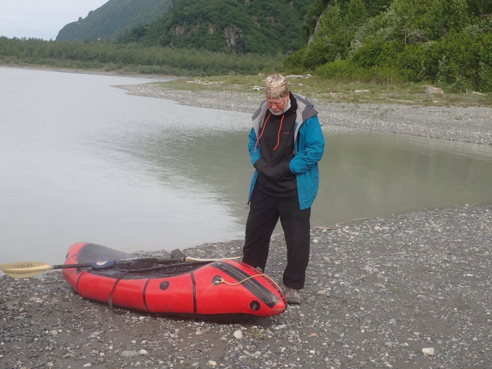
And in case we popped one of our humble little vessels
We found a potential replacement, even if it wasn't very packable....
 |
| Gunnar is so comfy in the water I have no doubt he'd be fine with this new old craft. |
Wind on the lake can be a big deal; brother Paul's trip was only able to make a mile or two in a full day. But our crossing day was benign:
And we weaved our way through the ice bergs
 |
| I try to avoid anthropomorphizing natural shapes, but it's ok if a 'berg looks like a chicken glancing over it's shoulder..... |
Soon enough we were back in the current
 |
| The scenery was as big as the river. |
 |
| the boats in the lower right put the river into it's big perspective. |
At camp Tim was doing his training for the Highland Games Big Stone Carry:
 |
| and both Gunnar and Tim were putting their impressive backcountry NOLS chef skills to good work, including a featherweight backpack-worthy Dutch Oven (the pan at his knees). |
 |
| Everyone on the trip was very studious |
And we saw some impressive climbers:
 |
| Those two black spots are bears. Mountain goats beware; blackies apparently climb rock as well as they ascend trees! |
 |
| This is approaching the burly Mt Blackadar, which indicates that Turnback Canyon is not far away. |
The typical last raft camp before Turnback is on the left a mile or two downstream on river left. But the glacier portage is on river right, and even though it added a coupla miles to our walk, we had a nice camp up higher and weren't sure what either the camping was like further downstream or the ability to get onto the glacier.
And thus we rolled up, packed up, and headed out for the portage
One "problem" that we had was that all of us had kinda packed more for paddling than for carrying and the big water meant that we were well-ahead of schedule, so we were on the heavy side. We didn't want to confirm how much our overloaded packs weighed, but our specially-calibrated bodies knew exactly: Too Much!
So slowly trudging, off we went to the galcier
 |
| the glacier is up over that horizon |
the gratuitous flower/beach shot:
and of course the gratuitous wow that is a big bear shot....
We weren't sure what to expect from the glacier: would there be open crevasses? slippery ice? tons of small moraine-scree ups and downs? The moraine on the side looked ok:
and then we mounted the ice:
and to our (well, at least my) surprise, the glacier was super benign
 |
| it was so buffed that I realized that mountain biking on glaciers - ala Curiak and Dial et al -may indeed be possible |
The views from the glacier were as big as those from the river
And provided a different perspective/experience than we had on the river
Even though it was flat and easy, we needed to give our shoulders a break from the weight, and soon enough got to the moraine on the other side of the glacier
The glacier itself created a lot of interesting little micro features
 |
| this manhole cover was welded to the ice underneath |
 |
| I couldn't figurer out why these lumps were there |
 |
| this crack was pretty bottomless with water running down into it. But the rocks on the surface created good traction |
and finally the river loomed and we scree-d on down to it
 |
| Not quite as easy as strolling along the white ice. |
Back at a riverside camp we had a nice thunderstorm show
And were back on the river the next day
A couple of river notes: Besides Turnback Canyon there are two other rapids that people worry about: Lava North and Sam and Bill's rapid. At our high water these turned out to be pretty inconsequential; just big roly waves, since the rocks that create more turbulence at lower flows were quite a bit deeper. That said, we had the beta to stay right of the island at Sam and Bill's, and looking upstream at the left side from below indicated some biggish action. At the risk of being a bit of a snobbish purist, it's disappointing to me that "they" (whoever they are) gave the biggest rapid on the Alsek a moniker that references another impressive river feature (Lava Falls in the Grand Canyon). Yes, there are some similarities, but in my notso-humble opinion the Alsek is so iconic that it should have its own very distinctive names.
Also, the river started out not nearly as cold as I anticipated, but much of the volume pump comes from glaciers (just upstream of our end-of-Turnback camp was a gigantic upwelling) and the water temp goes down to a temperature of wow, that's really cold water. Even though we had mild air temps and not as much wind as some folks experience, I had pogies on most of the time (though my tougher Alaskan compadres were mostly gloveless).
Soon enough we got to the Tatsenshini confluence where the river probably doubled in size, so -with the other smaller Alsek tribs - we were probably on around 100,000 cfs of silty rolling sea, still with Big Views
And below that was the Walker Glacier camp, which provided some nice reading time
 |
| Part of the weight I was carrying was a coupla books; I think I'm going iPhone books exclusively now.... |
When we did the Tat a dozen years ago going from camp to the Walker Glacier was maybe a half-mile and it was clear why it was called the "Walker" (because you could walk on it, not because of some dude named Walker). But the glacier has receded so far that hiking to it is pretty much not an option, there's a mile-long lake at the base, and the glacier itself is absolutely not walkable any more.
And we stayed away from the shore under the seracs in case they fell. I'm no global warming expert, glaciers are always dynamic, and for sure my sample size of exactly one is not very statistically significant, but seeing this monumental change in a relatively short time was stunning to me.
Alsek Lake is the next major feature, and due to its size with many glaciers feeding it, can be a bit of a challenge to navigate due to the proliferation of ice bergs and which way the wind blows them around (ie the river charges into the lake, and if the wind has pushed the 'bergs to the river mouth, you can basically be swept straight into a solid mass of ice bergs). But for us there were just enough bergs to be beautiful but not pose any problems.
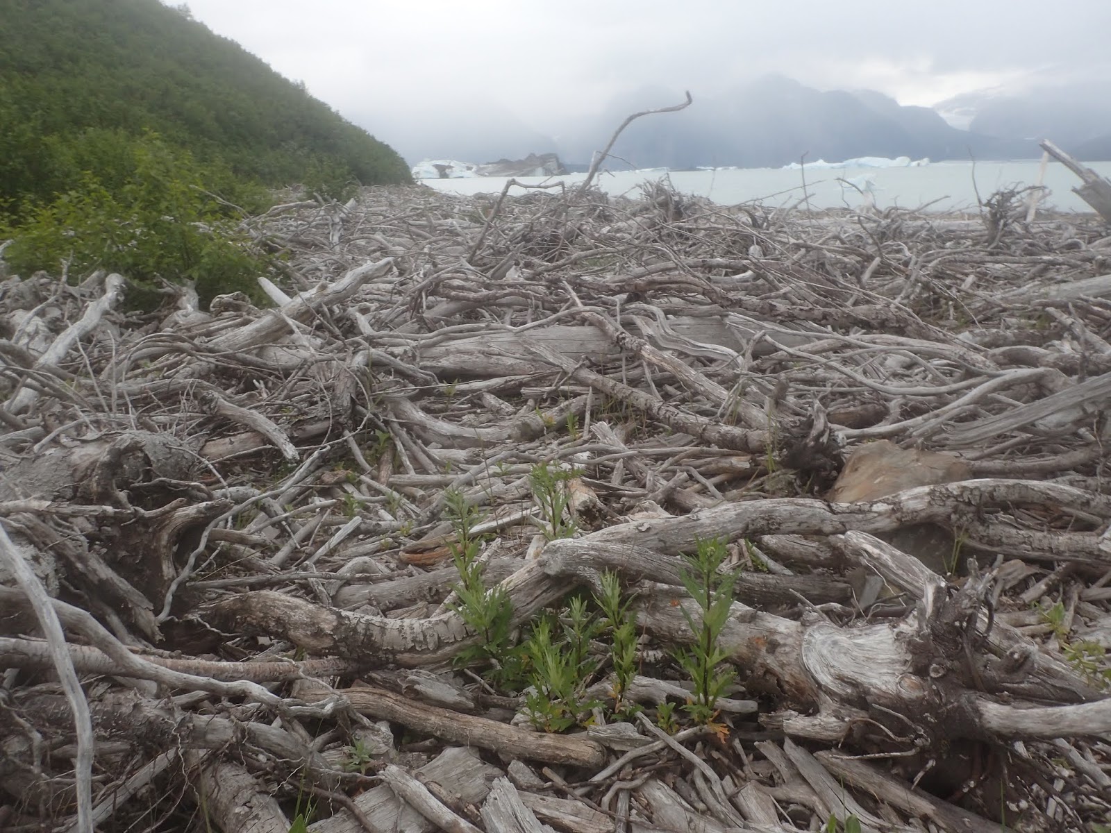
The wind blows a lot of driftwood onto the shores
We shared the Alsek Lake camp with two other raft parties, who were pretty amazed by our little boats:
 |
| Brad holding forth on pack rafting |
 |
| This guy just couldn't get over the concept. |
and just to ensure that our packs stayed nice and heavy for our coast hike, just as we were getting ready to "prepare" our joyless freeeze-dried dinners these guys showed up with dutch oven-baked turkey, potatoes, cranberry sauce, and beers for us....hard to pass that up, even if it means we were doomed to continue to carry uneaten food out! (I actually offloaded a bit of lunch food to these guys; probably the first time in history that self-contained kayakers gave food to rafters!).
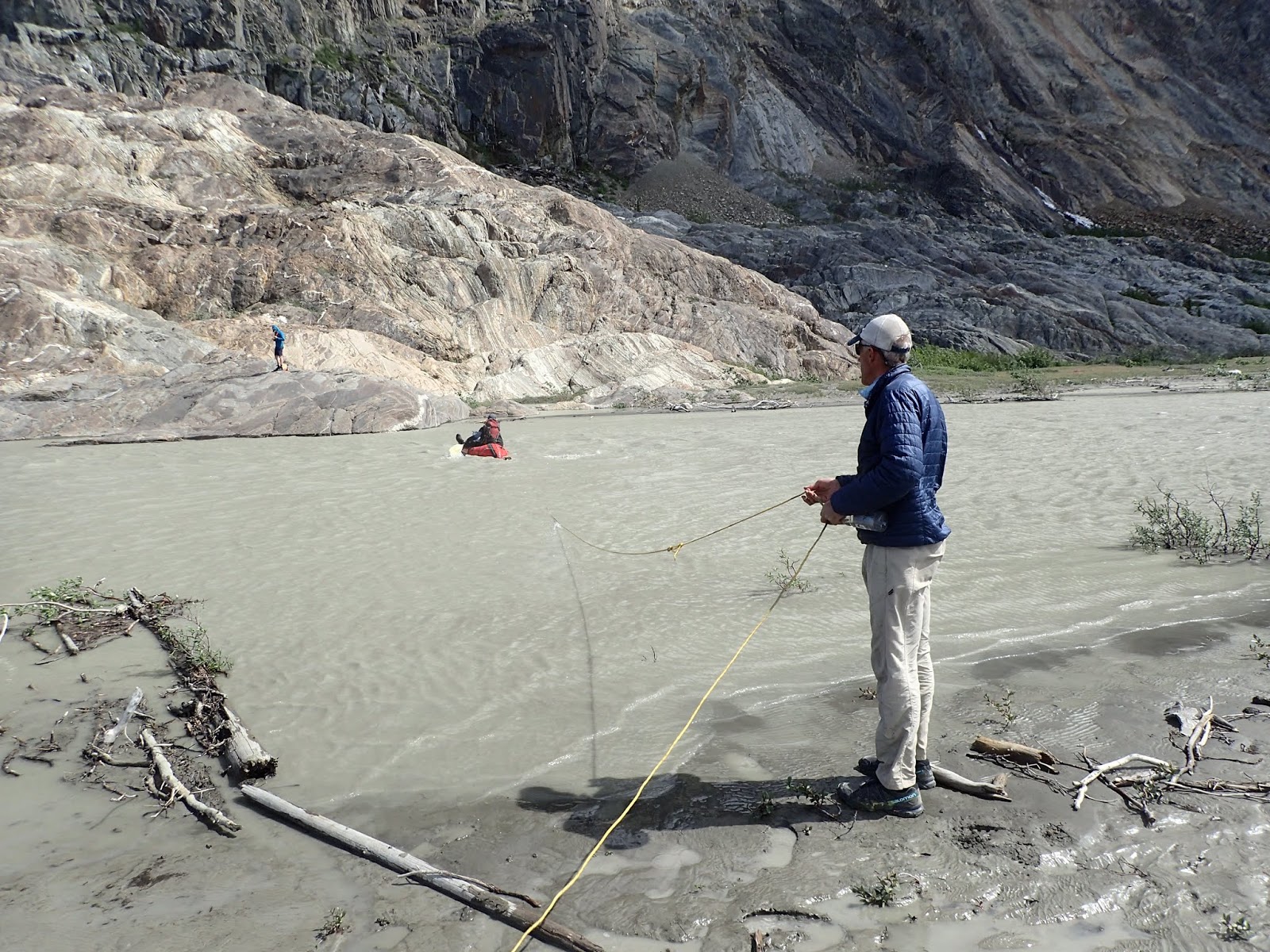
On down the river we went, watering up at our last non-silty, non-salt water source:
And on out to the bay where the mighty Alsek finally meets the Pacific
Looking back towards what would be an amazing view of Mount Fairweather:
Mt Fairweather was named by Captain Cook, apparently on one of the 6 days in the last few centuries that this 15,000 foot peak 20 miles from the ocean actually had Fair Weather.
Our exit at Dry Bay was guarded by a few of these guys:
and then we began our coastal trudge
Enough for now; will do a (shorter!) post on the last leg of the trip later.....


 When we did the Tat a dozen years ago going from camp to the Walker Glacier was maybe a half-mile and it was clear why it was called the "Walker" (because you could walk on it, not because of some dude named Walker). But the glacier has receded so far that hiking to it is pretty much not an option, there's a mile-long lake at the base, and the glacier itself is absolutely not walkable any more.
 And we stayed away from the shore under the seracs in case they fell. I'm no global warming expert, glaciers are always dynamic, and for sure my sample size of exactly one is not very statistically significant, but seeing this monumental change in a relatively short time was stunning to me.


Good write-up Tomster! I am curious of the name confusion of the two bigger rapids after Lowell Lake. Although there appear to be many other wave-filled rapids (II-III?) between Lowell Lake and Turnback Canyon, my understanding was that Sam's and Bill's Rapids were two separate rapids - which is the way Embick describes them (as well as the AWA description). Sam's Rapid, named "for Dee Crouch's wife" is the first big one after Lowell Lake located 11 km downstream (with a big island separating a class II-III river-right channel from the main class IV channel), and Bill's Rapid is named "for Bill Evans" and is at a left turn 15 km downstream of the lake (and is a one-channel class IV type rapid with possibility for class III skirting it on RL). It is Bill's Rapid that is also called "Lava North". I think the "Lava North" name was given by SOBEK - you can find a video of an MTS trip where the woman refers to it as Lava North. SOBEK guides also named a rapid on the BioBio "Lava South". Here's another writeup with comment on Lava North by some clients on an Alsek raft trip: https://www.wildernessriver.com/2013/02/newsfeed-whitewater/
ReplyDelete